
New URL For Future Posts:
Arizona100.WordPress.com
This blog has migrated to the above URL. Thank you Blogger for two years of hosting. Thank you Followers and everyone who left comments. The Centennial is here!
Monday, September 19, 2011
Monday, September 12, 2011
Winslow: The Meteor City
Is Still In Motion
In 1876, the LDS church called missionary families to colonized the relatively unpopulated Little Colorado River valley in northeastern Arizona. They were to establish towns along a transportation corridor down the eastern part of the territory all the way into Mexico, along what would come to be called the Honeymoon Trail because so many of the colonists married just before setting out on their journey. Making the perilous crossing of the Colorado River at Lee’s Ferry, wagon trains forded the Little Colorado at Sunset Crossing, before the stream plunged into a deep gorge on its way to the Grand Canyon.
Two of the first four groups settled at the crossing, where they made Smith’s Camp and Ballinger’s Camp, named after their leaders. The others made Lake’s Camp and Allen’s Camp farther upstream. They were directed by church leaders to build forts for protection and they were skilled at placing brush dams across the river and running ditches to irrigate fields. The importance of cooperation to efficient agriculture and a desire to maintain discipline in the wilds of eastern Arizona must have convinced many of these settlers to follow the communal lifestyle known as the United Order. Life in the forts would require shared work. They enjoyed private sleeping quarters but ate meals in a common dining room. United Order communities adopted a communist economy, without ownership of animals, tools, furnishings or housing. The community at Lakes’ Camp was named Obed, while those in Smith’s Camp called their place Sunset City (USPO “Sunset”). Two years later, Ballinger’s Camp was named Brigham City and Allen’s Camp became St. Joseph (later Joseph City).
But the harsh environment, which included strong winds, alternating drought and flood, and alkali soil, led to the failure of three of the four communities within five years. Brigham City was abandoned in 1881, while Sunset survived until early 1887. The United Order failed too. It was dependent upon free public land, it tolerated no dissent and some families desired the full benefit of their individual initiative. When Atlantic and Pacific Railroad construction crews reached Sunset Crossing toward the end of 1881, they could stay in the abandoned Brigham City fort until a town was built closer to the tracks. The railroad named the new town Winslow, after a former president of the St. Louis and San Francisco Railroad, which had partnered with the Atchison, Topeka and Santa Fe to bankroll the A & P.
 Note how Brigham City was located on the west side of the river in Section 18 (on the east side of the present day golf course). Sunset City was located on the east bank. When section lines were resurveyed, Sunset was found to be in the northwest corner of Section 16. In the 1880s, the A & P rail yard was on the east side of Winslow, putting downtown at the left edge of this map. Clear Creek provided an abundant supply of water, leading the railroad to locate refueling facilities, machine shops, a roundhouse and a housing for workers. Additionally, Winslow was a convenient maintenance point because it was the lowest elevation between the Continental Divide at Gonzales, New Mexico and Arizona Divide at Riordan, Arizona. (Map by David F. Myrick from his book, The Santa Fe Route, (1998), page 19.)
 Boys pose for the photographer on a string of coal cars parked on the turning wye that used to run along Campbell Avenue in this photo looking east around 1892. In those days locomotives burned coal mined near Gallup but Winslow would remain a refueling point even after the switch to oil. St. Joseph’s Catholic Church (1892), on the NE corner of Winslow Avenue and Front Street has the dark roof (Second St. today, not the Front Street south of tracks). There are two other churches on either side of the Catholic church. Front Street, also called Railroad Avenue and finally Second Street, runs by the churches, past the commercial district, leading to the railroad roundhouse and shops visible at upper right (last white building at right). Today’s First Street is also at right, but only extends two blocks. In the 1890s there were no commercial buildings on the south side of Railroad Avenue, only a wide vacant space extending to the tracks. You can see that at extreme right. The tops of a few stores are visible in front of the plume of smoke coming from the roundhouse. The tracks are out of view to the right. On the south side of the tracks, the A & P provided 13 railroad employee cottages by 1887 (not visible here). The number expanded to 63 by 1891. The cookie-cutter roofs at upper left resemble employee housing and may be some of the newer cottages on the north side. (National Archives and Records Administration photo.)
 Railroad Avenue (now Second St.) looking east about 1906, shows two blocks of a basically four block business district. Some of the buildings (from left) are: Winslow Opera House (red brick)—later site of B. P. O. Elks bldg.; Hotel Navajo (whitewashed); news stand, confectionary & post office (dark parapet); men’s clothing store, then a plumbing supply (greenish); drugstore (yellow); Babbit Brothers Mercantile with Masonic Hall above (red); Star Grocery with Knights of Pithias above (white); and then Williamson Avenue. The Arizona Central Hotel (1885), first business in Winslow, is the two-story white building near the end of the next block. Then comes the railroad shop attached to the roundhouse (red) blocking the street at far right. The LaPrade family owned the Opera House with Holbrook druggist Frank Wattron (1861-1905) as partner. There was also a jeweler and tailor shop at the front of the building.
 The eastside roundhouse and machine shops completely burned in 1895 but were rebuilt. The A & P Railroad went bankrupt and was reborn in 1897 as the Santa Fe Pacific Railway under Atchison, Topeka & Santa Fe control. The ATSF purchased Santa Fe Pacific railroad property in 1902, adding it to the Santa Fe System. Then in 1913, the Santa Fe Railway began a major expansion on the west side of Winslow that included a new roundhouse, machine shop and power plant as shown here. The east side facilities were then demolished. This roundhouse lasted until recently. The correspondent who mailed the postcard in 1918 wrote on the front, “The train shoke [shook] so much I can’t write very good.”
 Santa Fe Train No. 7, shown here about 1910, was a westbound fast mail and express from Chicago to Los Angeles (No. 8 was the eastbound fast mail). Double-headed to maintain speed on the steep grades in New Mexico and Arizona, it pulls a long string of express cars, followed by passenger coaches. This view looks east from a point near the railroad hospital (constructed 1902). The combination depot, Harvey House hotel and restaurant building is at right. The employee reading room (see below) is out of view behind the trees at right, within the fence. Fred Harvey (1835-1901) contracted with the A & P and the Santa Fe Railway to provide “eating houses” along the line, later attached to hotels. The first was at Topeka, Kansas, staffed by iconic “Harvey girls.” There were Harvey House hotel/restaurants in Arizona at Winslow, Williams, Grand Canyon, Ash Fork, and Seligman, with an eating house at Kingman and a café on Route 66 overlooking the Painted Desert.
 The Glessner family of Minnesota preserved some postcards from an ancestor’s March 1929 trip on the Santa Fe through Winslow and have made them available on the internet. Grandpa Harry wrote on this Fred Harvey published Phostint card, “This is the ‘old noise’ hotel. They are going to build the biggest & best of all on the other side of the track.” A Fred Harvey eating house opened temporarily in boxcars in Holbrook then relocated to Winslow in 1887. It was replaced in 1897 with a larger hotel and restaurant. That building was gutted by fire in 1914 but rebuilt and enlarged as shown here. Construction began in 1929 on La Posada depot, restaurant and hotel on the north side of the tracks. But even after La Posada opened, this building survived for many years. It’s gone now, but Winslow has a Harvey girls group that interprets the atmosphere of that era for visitors.
 Patterned after Women’s Christian Temperance Union reading rooms, the Santa Fe System established similar rooms for employees in 1889 as a recreational alternative to billiard rooms and roulette tables in saloons. The reading rooms were closed during the recession that began in 1893, which soon led to both the A & P and ATSF railroads filing for bankruptcy protection. Widely praised for their positive effects on morality, reading rooms reopened as the railroads emerged from receivership in 1896. There were 23 reading rooms by 1901. In 1913 there were 13 rooms and five combined reading rooms and clubhouses costing $50,000 a year to maintain. This building was constructed in 1903 at a cost of $20,000. I don’t know how long it stayed open, but the one in Belen, New Mexico closed in 1980. The building with the orange roof visible through the trees is the railroad hospital.
 When La Posada Hotel opened 15 May 1930 the economy had just crashed and it was the last of the Harvey House hotels built in the grand style. The attached passenger depot is just out of view at right. Fred Harvey architect and interior designer Mary Colter (1869-1958) chose a Spanish-Mediterranean design, which had replaced the mission style in popularity. She created a mythical history for the building as a Spanish hacienda, furnishing the 70 rooms and five suites with antique and replica furniture. Throughout the hotel, dining room, lunchroom and train station, every detail from reverent statues of patron saints to whimsical jackrabbit ashtrays stimulated the emotional experience of guests. But after rail passenger traffic began to falter, La Posada closed in 1957 and the furnishings were auctioned off in 1959. An east wing was remodeled to serve as Santa Fe Railway offices for the Albuquerque-Winslow Division. When the railroad announced in 1994 that it would leave, Allen Affeldt and Tina Mion purchased the building and began a restoration 1997-1999. The railroad decided to stay and the hotel and restaurant reopened. The original exterior had been painted light pink, but it is now beige, closer to the color on this Fred Harvey postcard issued in 1937.
The Santa Fe Railway began running diesel electric freight locomotives in 1941 and picked Winslow as a diesel service point. At the time “Winslow was a cowtown of 3500, shopping center for Navajos and Hopis and jumping-off place for tourists who had read the ads about the Painted Desert and Petrified Forest (p.44, Roderick M. Grant, “The Navajos Call It ‘Lightning Wagon,’” Popular Mechanics, Sept. 1945.) Then, servicing nearly 80 of the General Motors built units, which made the trip from LA to Chicago at 60 mph in 41-and-a-half hours, doubled the population, making Winslow “Diesel Capital of the World” according to the railroad. Wartime traffic had a train arriving or leaving every 12 minutes. But after World War II a dispute with city government over expansion of Santa Fe shops persuaded the railroad to move its diesel service to Barstow.
 Cross-country automobile and air transportation offered competition for trains beginning in the 1920s, and Winslow was in a good position to capitalize on both new forms of traffic. Local druggist and lawyer, Grover Cleveland Bazell (1889-1938), established a Buick dealership in 1921 and then Bazell Camp Ground for tourists at 800 West Second Street. Extensively remodeled in 1950, it became Bazell Modern Court. It closed many years ago and is now a private residence. Besides Bazell’s, earliest auto courts in town included Drumm’s Auto Court, Union Auto Court and West End Tourist Camp.
Route 66 was not a fun highway in years past. In the hot August of 1926, a traveler wrote home to Oklahoma on a postcard showing Winslow’s Second Street, “Here we are down the street a block in a garage getting a piston rod fixed. It burned out ours. We have had five punctures [in tires]. I bought a frosted Coca-Cola yesterday in this drug store, and they soaked me two bits for it. Across the street a soda only cost $ .15.” Coca-Cola in a 6-ounce bottle usually sold for 5-cents at the time. The garage was likely Bazell Motor Company, where the Dodge dealership used to be in the 1960s. Even after paving 1932-1937, in most places US Highway 66 was a narrow two-lane, dangerous highway. Some in Missouri called it “Bloody 66.” At one time, one in seven highway accidents in Arizona occurred on Route 66.
 Standing on a corner in Winslow, Arizona was popular even back when Burton Frasher of Pomona made this photo about 1941. That’s Frasher’s car at the curb. The city street is carrying thru traffic on Route 66. Winslow Drug Company, the Walgreen Agency at 100 W. Second Street, had recently moved closer to the corner. To the west are the J. C. Penney and Babbitt’s Hardware stores. St. Joseph Catholic Church, rebuilt in stone with a tall steeple, is visible two blocks away. On the south side of the street you can see the neon sign for Bruchman’s Indian Curios. R. M. Bruchman (1880-1986) established an Indian crafts business in 1909 and opened his store at 113 W. Second in 1921. It closed in 1996. The Walgreen drugstore on the NW corner of Second and Kinsley was demolished and is now the site of Standing on the Corner Park. The J. C. Penney building burned in 2004, but the east wall with its mural was saved.
 Moving almost a block east on Second Street, Frasher took this photo about the same time as above. This is the same block of buildings shown on the circa 1906 postcard above, only looking in the opposite direction. Down at the intersection with Kinsley is Central Drug Company, the Rexall store across the street from the Walgreens Agency, in the building built in 1912 for the Elks club on the site of the Opera House. Moving east is the Palace Hotel (formerly Navajo Hotel), then Quality Bakery (former newsstand), Grand Café, Chief Theater, White Café (in the former Babbitt Bro. bldg.), Skylark Cocktails, National Café and Sprouse-Reitz 5-10-15-cent Store (in 1916 Old Trails Garage bldg.). Many of these buildings have survived. The Chief Theater was torn down.
 While America improved cross-country highways it also began building a transcontinental airline industry. Hardly rested from his 1927 trans-Atlantic flight, Charles Lindbergh flew into Winslow the following year to select a site and design an airport for his new airline, Transcontinental Air Transport (TAT, became TWA, “The Lindbergh Line”). Passengers traveling from New York to LA over two days would fly in the clouds all day but sleep on a speeding train at night. TAT constructed Winslow Barrigan Airport and beginning 7 July 1929, Ford Tri-Motors from Clovis, New Mexico stopped there for 15-minutes on the way to Los Angeles. The first airmail flight out of Winslow soon followed, on October 25, 1930. Twin-engine DC-3s, as pictured here, were used by 1936. And by 1948, when this photo was made, Winslow was still a busy maintenance site for TWA, one of its interstate hubs. But TWA was already adding bigger planes with much longer range. The airline gave the airport to the City in 1941, making it Winslow Municipal Airport. Today, its name reflects its history: Winslow-Lindbergh Regional Airport (INW). Frontier Airlines replaced TWA at Winslow in 1950. SkyWest Airlines began service at Winslow in 1978. Though all airline service ceased in the 1980s, the hangar is still used for private planes. In addition, the forest service has a strategic slurry bomber base at INW. Winslow’s largest ethnic minority has long been a number of Hispanic families, followed in number by American Indians. Historic Hispanic neighborhoods were South Side, and Coopertown, located south of the tracks and just north of the airport.
At an elevation slightly over 4,800 feet (USGS 1986), Winslow is at the lowest elevation on the Colorado Plateau in Arizona. Consequently, it has long been subject to flooding from the nearby river. The greatest flood came September 17-18, 1923, when the maximum river flow ever recorded at Holbrook was nearly three times that of other floods. The river overtopped its banks again in 1927 and on August 3, 1959 caused $25,000 in damages at Winslow. The flood of August 1964 put water in many streets and even flooded the airport according to a government map. A levee protecting Bushman Acres on the northeast side broke in December 1978 and several neighborhoods were inundated. That flood hampered construction of the new I-40 bridge across the river.
 Motel Town House, at 1914 W. Third Street, remained close enough to the west freeway exit to survive after I-40 bypassed Winslow to the north. And it’s still in business as a TraveLodge. But many other Mid-Century Modern design motels are a thing of the past. Post-Modern design motels are now clustered around North Park Exit. This postcard by Petley Studios of Phoenix shows the 56-room hostelry about 1960. Vacationers found Winslow, “The Meteor City,” a comfortable stay while visiting the impact crater 25 miles west or the Hopi pueblos 70 miles north. Recently, city leaders switched the catch phrase from “Meteor City” to “A city in motion,” referring to the transportation economy. The idea is to “move forward,” while still “cherishing the past.”
 As in Ash Fork and Williams, Route 66 was split through downtown Winslow, with eastbound traffic on Second Street (right of center) and westbound on Third. It’s easy to trace the highway in this Agfachrome aerial photo looking east, made by Bob Petley in the 1960s. The roundhouse is out of view under the tail of Petley’s airplane. The tall, white water tank (at right) is in the middle of the turning wye where it leaves the rail yard. La Posada is located in the trees near the other water tank. Navajo Ice & Cold Storage Company plant is visible at lower right. The icing platform with icing machine lines a side track. Under a 1904 contract with the railroad, A. P. Maginnis (1848-1911) of Los Angeles built an ice plant to supply rail refrigerator cars and electricity to the town. Rail cars switched to mechanical refrigeration by the 1960s and the ice plant is no longer there. The Little Colorado River runs across the top of the postcard. Bushman Acres is at top left.
Winslow enjoyed the largest population in northern Arizona from 1900 until 1950. It was the most populous community in Navajo County until passed by Show Low in the last five years. But Winslow’s transportation based economy could no longer offer widespread prosperity by 1970, leaving a large population of low-income families with difficulty finding affordable housing. A BVD T-shirt factory at Hopi Industrial Park only lasted from 1969 to 1975. Workers there had a choice of daily driving 140 miles to and from the Hopi pueblos or paying for housing in Winslow. Interstate-40 bypassed the downtown in 1979 and shortly afterward the railroad began cutting back operations. There were more than 950 railroad employees in town in 1970 but only about 500 in 2004. Winslow got the state legislature to open a medium security prison in 1986 that would eventually employ 500 workers by 2004. In 1958, there had been two sawmills in Winslow cutting logs from the nearby mountains, the Nagel mill in operation since November 1942 and Gallagher mill operating since 1950. Duke City Lumber Co. acquired the Gallagher mill in 1958. Precision Pine purchased from Duke City in 1991 but closed the sawmill eight years later.
Winslow has faced few options. Despite access to transportation, attracting factories hasn’t panned out. From its founding, Winslow benefited from large nearby cattle ranches, recently supporting as many as 100 jobs. Shopping still brings American Indian families for the day. But like many rural Arizona towns, government is the biggest employer, largely at schools and the prison. With a need to once again promote tourism, on historic Route 66 this time, the La Posada Foundation dedicated Standing on the Corner Park 11 September 1999. The park is a tribute to the 1972 song “Take It Easy,” sung by the Eagles. They even keep a flatbed Ford parked at the curb. Just as Mormon farmers found, prosperity won’t come easy in today’s economy either, but maybe preserving history can keep Winslow in motion rather than left standing on a corner.
See:
Arizona Dept. of Commerce, Economy of Winslow, (2008)
William Patrick Armstrong, Fred Harvey, (2000)
Center for Desert Archaeology, Archaeology Southwest, Spring 2005, several articles on Mormon settlements at Winslow.
Federal Emergency Management Agency (FEMA), Flood Insurance Study of Navajo County, (2003)
Virginia L. Grattan, Mary Colter, (1992)
Janice Griffith, “La Posada Catered to Route 66 & Santa Fe Crowd,” Route 66 Magazine, Winter 1993-1994
Ann Patterson & Mark Vinson, Landmark Buildings, (2004)
Charles S. Peterson, Take Up Your Mission, (1973)
Joe Sonderman, Route 66 in Arizona, (2010)
Michael Karl Witzel & Gyrel Young-Witzel, Legendary Route 66: A Journey Through Time Along America’s Mother Road, (2007)
Is Still In Motion
In 1876, the LDS church called missionary families to colonized the relatively unpopulated Little Colorado River valley in northeastern Arizona. They were to establish towns along a transportation corridor down the eastern part of the territory all the way into Mexico, along what would come to be called the Honeymoon Trail because so many of the colonists married just before setting out on their journey. Making the perilous crossing of the Colorado River at Lee’s Ferry, wagon trains forded the Little Colorado at Sunset Crossing, before the stream plunged into a deep gorge on its way to the Grand Canyon.
Two of the first four groups settled at the crossing, where they made Smith’s Camp and Ballinger’s Camp, named after their leaders. The others made Lake’s Camp and Allen’s Camp farther upstream. They were directed by church leaders to build forts for protection and they were skilled at placing brush dams across the river and running ditches to irrigate fields. The importance of cooperation to efficient agriculture and a desire to maintain discipline in the wilds of eastern Arizona must have convinced many of these settlers to follow the communal lifestyle known as the United Order. Life in the forts would require shared work. They enjoyed private sleeping quarters but ate meals in a common dining room. United Order communities adopted a communist economy, without ownership of animals, tools, furnishings or housing. The community at Lakes’ Camp was named Obed, while those in Smith’s Camp called their place Sunset City (USPO “Sunset”). Two years later, Ballinger’s Camp was named Brigham City and Allen’s Camp became St. Joseph (later Joseph City).
But the harsh environment, which included strong winds, alternating drought and flood, and alkali soil, led to the failure of three of the four communities within five years. Brigham City was abandoned in 1881, while Sunset survived until early 1887. The United Order failed too. It was dependent upon free public land, it tolerated no dissent and some families desired the full benefit of their individual initiative. When Atlantic and Pacific Railroad construction crews reached Sunset Crossing toward the end of 1881, they could stay in the abandoned Brigham City fort until a town was built closer to the tracks. The railroad named the new town Winslow, after a former president of the St. Louis and San Francisco Railroad, which had partnered with the Atchison, Topeka and Santa Fe to bankroll the A & P.


The Santa Fe Railway began running diesel electric freight locomotives in 1941 and picked Winslow as a diesel service point. At the time “Winslow was a cowtown of 3500, shopping center for Navajos and Hopis and jumping-off place for tourists who had read the ads about the Painted Desert and Petrified Forest (p.44, Roderick M. Grant, “The Navajos Call It ‘Lightning Wagon,’” Popular Mechanics, Sept. 1945.) Then, servicing nearly 80 of the General Motors built units, which made the trip from LA to Chicago at 60 mph in 41-and-a-half hours, doubled the population, making Winslow “Diesel Capital of the World” according to the railroad. Wartime traffic had a train arriving or leaving every 12 minutes. But after World War II a dispute with city government over expansion of Santa Fe shops persuaded the railroad to move its diesel service to Barstow.

Route 66 was not a fun highway in years past. In the hot August of 1926, a traveler wrote home to Oklahoma on a postcard showing Winslow’s Second Street, “Here we are down the street a block in a garage getting a piston rod fixed. It burned out ours. We have had five punctures [in tires]. I bought a frosted Coca-Cola yesterday in this drug store, and they soaked me two bits for it. Across the street a soda only cost $ .15.” Coca-Cola in a 6-ounce bottle usually sold for 5-cents at the time. The garage was likely Bazell Motor Company, where the Dodge dealership used to be in the 1960s. Even after paving 1932-1937, in most places US Highway 66 was a narrow two-lane, dangerous highway. Some in Missouri called it “Bloody 66.” At one time, one in seven highway accidents in Arizona occurred on Route 66.


At an elevation slightly over 4,800 feet (USGS 1986), Winslow is at the lowest elevation on the Colorado Plateau in Arizona. Consequently, it has long been subject to flooding from the nearby river. The greatest flood came September 17-18, 1923, when the maximum river flow ever recorded at Holbrook was nearly three times that of other floods. The river overtopped its banks again in 1927 and on August 3, 1959 caused $25,000 in damages at Winslow. The flood of August 1964 put water in many streets and even flooded the airport according to a government map. A levee protecting Bushman Acres on the northeast side broke in December 1978 and several neighborhoods were inundated. That flood hampered construction of the new I-40 bridge across the river.


Winslow enjoyed the largest population in northern Arizona from 1900 until 1950. It was the most populous community in Navajo County until passed by Show Low in the last five years. But Winslow’s transportation based economy could no longer offer widespread prosperity by 1970, leaving a large population of low-income families with difficulty finding affordable housing. A BVD T-shirt factory at Hopi Industrial Park only lasted from 1969 to 1975. Workers there had a choice of daily driving 140 miles to and from the Hopi pueblos or paying for housing in Winslow. Interstate-40 bypassed the downtown in 1979 and shortly afterward the railroad began cutting back operations. There were more than 950 railroad employees in town in 1970 but only about 500 in 2004. Winslow got the state legislature to open a medium security prison in 1986 that would eventually employ 500 workers by 2004. In 1958, there had been two sawmills in Winslow cutting logs from the nearby mountains, the Nagel mill in operation since November 1942 and Gallagher mill operating since 1950. Duke City Lumber Co. acquired the Gallagher mill in 1958. Precision Pine purchased from Duke City in 1991 but closed the sawmill eight years later.
Winslow has faced few options. Despite access to transportation, attracting factories hasn’t panned out. From its founding, Winslow benefited from large nearby cattle ranches, recently supporting as many as 100 jobs. Shopping still brings American Indian families for the day. But like many rural Arizona towns, government is the biggest employer, largely at schools and the prison. With a need to once again promote tourism, on historic Route 66 this time, the La Posada Foundation dedicated Standing on the Corner Park 11 September 1999. The park is a tribute to the 1972 song “Take It Easy,” sung by the Eagles. They even keep a flatbed Ford parked at the curb. Just as Mormon farmers found, prosperity won’t come easy in today’s economy either, but maybe preserving history can keep Winslow in motion rather than left standing on a corner.
See:
Arizona Dept. of Commerce, Economy of Winslow, (2008)
William Patrick Armstrong, Fred Harvey, (2000)
Center for Desert Archaeology, Archaeology Southwest, Spring 2005, several articles on Mormon settlements at Winslow.
Federal Emergency Management Agency (FEMA), Flood Insurance Study of Navajo County, (2003)
Virginia L. Grattan, Mary Colter, (1992)
Janice Griffith, “La Posada Catered to Route 66 & Santa Fe Crowd,” Route 66 Magazine, Winter 1993-1994
Ann Patterson & Mark Vinson, Landmark Buildings, (2004)
Charles S. Peterson, Take Up Your Mission, (1973)
Joe Sonderman, Route 66 in Arizona, (2010)
Michael Karl Witzel & Gyrel Young-Witzel, Legendary Route 66: A Journey Through Time Along America’s Mother Road, (2007)
Friday, August 12, 2011
U-V-X-Z: The Sad History
of Valentine
This blog has presented histories of Arizona Communities, one for each letter of the alphabet. But few places took names beginning with U, X and Z. “Union” was the first name chosen for the town of Eagar in Apache County, and Lehi, now absorbed by Mesa, was first called Utahville. Zenos was the first designation for Mesa, and there was a ranch community called Zeniff about 25 miles west of Snowflake. Arizona Place Names has no listings beginning with “X” and the USGS Geographic Names Information System gives no populated place beginning with “X.” There are, however, a number of small places, including Vail, Valle, Vekol and Vernon, beginning with “V.” And then, there was Valentine.
Place names are confusing in the Valentine area. When the Atlantic & Pacific railroad built across northern Arizona 1880-1883 it followed the Beale Road of 1857. Beale had traveled a dry wash through a canyon in order to descend the high Grand Wash Cliffs, one of the western stair steps off the Colorado Plateau. He named a spring in the canyon Truxton Spring, using a family name. When the A & P built through the same canyon, railroad workers saw Truxton Wash flowing through two canyons really, the upper, narrow Crozier Canyon and the lower, wider Truxton Canyon. There were three important springs in the area, Crozier Spring to the north, Truxton Spring in the Canyon and Cottonwood Spring to the south. The Cottonwood Cliffs are a southern extension of the Grand Wash Cliffs. In 1883, the A & P put in a large pump and tank fed by Truxton Spring to provide water for thirsty steam engines.
 The Fred Harvey Company issued about 1915 this postcard of the Santa Fe Railway (successor to the A & P) passenger train called The California Limited in Crozier Canyon. The route offered a convenient grade but was subject to washouts when the normally dry stream would suddenly become a tremendous rushing torrent thirty feet deep. The tracks had to be relocated to slightly higher ground after a 1904 flood. The line was double-tracked through the canyon 1922-1923 and is still in use. This “Phostint” card by Detroit Publishing Company relates: “In this canyon is a U. S. Government Indian school, where the Hualapai and Havasupai Indians are made over into educated citizens.” The school was not located in the canyon depicted, but at least five miles downstream.
 The Massachusetts Indian Association founded Hackberry Day School in 1894 on the railroad along Truxton Wash. Hualapai families had objected to sending their children far away for education, especially after two students died at Albuquerque. The day school soon moved four miles east of Hackberry, to the George Aitken (1844-1912) ranch on the railroad, where President McKinley established the Hualapai Indian School Reserve in 1898. There, the federal government established Truxton Canyon Indian School in 1901, in a small valley on the west side of the railroad. This is a picture of the brick dormitory as seen from the tracks before 1912. Sleeping porches for health and comfort were added in 1912 at each end of the building since there was no air conditioning in those days. Students lived at the school September to May, wrestling with disease, culture shock and homesickness. Spanish influenza took the lives of 22 children and adults between October 1918 and January 1919. The school closed in May 1937 and the dorm was demolished in 1960. Its bricks, manufactured on site with Indian labor, were recycled to build the Mohave County Museum of History and Arts in Kingman.
 This structure housed the boarding school office and US Post Office. The Post Office was established in 1901 as Truxton. The name was changed in 1910 to Valentine, in honor of Commissioner of Indian Affairs Robert G. Valentine (1872-1916). When the school closed, the post office moved off reservation, two miles away, to the service stop on Route 66. The old post office building is one of the few survivors from school days. The boarded-up classroom is also still there. A short distance away the Truxton Canyon Agency of the US Bureau of Indian Affairs now maintains its offices. Non-Indian children used a nearby wood frame building called the Red Schoolhouse 1924-1969.
 After finding the Hackberry Mine with a partner, Sam Crozier (1840-1901) acquired Crozier Ranch in 1880, established by others in 1872. C. J. Shank leased the property in 1923, built a swimming pool and created a little resort, mostly for well to do families from Kingman. Not long after the National Old Trails Road became US 66 Edward M. Carrow (1876-1945) and his wife Edith opened a tourist camp at the ranch. The facilities shown here were located along the highway about a half-mile east (the highway actually runs north at that point) of Crozier station on the railroad. This hand-colored Albertype view, looking south, shows the Carrows’ 7-V Ranch Resort (or 7-V Bar, see map below) about 1934. A cross-country bus has stopped at the café and filling station just off the dirt road that was Route 66 back then. Most of the resort and swimming pool, are in the trees (cabins at right). Truxton Canyon is in the distance. Carrow was a cattle rancher, in partnership with his brother Murray and then with I. M. George of Kingman for a time. The normally dry wash from Crozier Spring would sometimes flood, stopping traffic on the highway, despite the bridge visible at lower left. In 1936 the Arizona highway department relocated Route 66 to higher ground out of view at right and the Carrows’ business was ruined. They were compensated by the taxpayers (see 1941 court case “State v. Carrow” Vol. 57 Arizona Reports pp. 436ff.) and the site reportedly provided housing for railroad workers by the 1940s. Others purchased the Crozier cattle ranch and tried to keep it open for tourists until the 1990s.
Section points on the railroad west of Peach Springs in 1921 were named Cherokee, Truxton, Crozier, Valentine and Hackberry. Cherokee Point, on the mountains southwest of Peach Springs, probably gave its name to the section point on the railroad. Crozier was named for cattleman and state legislator Sam Crozier. The Hackberry Mine, named for a large hackberry tree, was located around 1875 in the hills south of the railroad. Truxton Spring gave its name to a point on the railroad, the Indian school, and later, a service stop on Route 66 six miles east of Valentine. In the 1880s, Truxton on the railroad may have been located at the point now called Crozier, but when the place name “Crozier” shows up on rail maps, “Truxton” is then applied to a siding at the eastern entrance to Crozier Canyon, where it remains today. In 1951, two men located a café and gas station on Route 66 between Crozier and Peach Springs, naming the stopping place Truxton because the siding was the closest point on the railroad. Named points on the railroad were placed where section maintenance gangs lived or stored tools, or where passenger stations, passing and parking sidings or cattle loading sidings were located.
 The Automobile club of Southern California 1932 guidebook to Route 66 maps the area around Valentine. The location of the future Valentine service stop on the highway is identified as “Oasis,” watered by a nearby spring. Later there would be an “Oasis Store” at Valentine. The only Valentine on this map, however, is Valentine siding on the railroad. Notice how the dirt road that was US 66 crossed under the railroad at Crozier by following a side drainage under a bridge and then returned to the west side of the tracks via another underpass before the school. Route 66 was a slow and winding road back then, subject to closure during flood or heavy snowfall. By making deep grade cuts, the highway was straightened 1936-37 to avoid flooding and no longer crossed under the tracks. In 1937, the route through Truxton Canyon was the last section across Arizona to be paved. At the same time the government school closed and Oasis became the new location for the Valentine post office.
 The service stop of Valentine was built on private land about a mile west on Route 66 (actually south at this point) from the Crozier depot. You can see the Santa Fe tracks at right and a Texaco station on the west side of the highway (view is to NNE). In addition to cabins for spending the night, for a time there was also a small store. It was called Oasis Store when operated by Mr. & Mrs. William Scaggs in the 1950s. The school was located almost two miles west of here on the highway.
At some point, the Valentine post office began re-mailing holiday cards for postal customers, applying a unique heart-shaped cancel to the stamp. Soon, bundles of valentines from all across the country would arrive at the remote post office, spreading fame for the Arizona place name. For a time, Valentine, Arizona became associated with happy thoughts. Traffic on Route 66 increased every year after World War II until the new Interstate-40 freeway bypassed 159 miles of Route 66 from Ash Fork to Kingman. The freeway bypass opened 22 September 1978, leading to the immediate decline of business along the old alignment of Route 66. US Highway 66 was decommissioned as a federal highway in 1985. In 1990, Congress began the process to designate Route 66 remnants part of a historical transportation corridor with US Park Service interpretation. In August of that same year, a man robbed the Valentine Post Office and murdered Postmaster Jacqueline Ann Grigg. The post office and Union 76 station closed, located at that time at least three miles west of the old Oasis site according to one source, close to Valentine siding on the railroad.
On to histories of Winslow and Yuma, and then attention will be given to some of those communities passed over in the alphabet, like Prescott and Tombstone.
See:
Will C. Barnes, Arizona Place Names, (1935, 1988)
Spencer Crump, Route 66, (1994)
David F. Myrick, The Santa Fe Route, (1998) Railroads of Arizona, Vol. 4
Sam Negri, “Crozier Canyon Ranch,” (1994) at Arizona Scenic Roads website.
Russell A. Olsen, The Complete Route 66 Lost & Found, (2008)
Jack Rittenhouse, A Guide Book to Highway 66, (1946)
A. F. Robinson, “Floods on the Santa Fe System,” The Railway Age, December 16, 1904, pp. 850-852
Joe Sonderman, Route 66 In Arizona, (2010)
Michael Wallis, Route 66: The Mother Road, (1990)
of Valentine
This blog has presented histories of Arizona Communities, one for each letter of the alphabet. But few places took names beginning with U, X and Z. “Union” was the first name chosen for the town of Eagar in Apache County, and Lehi, now absorbed by Mesa, was first called Utahville. Zenos was the first designation for Mesa, and there was a ranch community called Zeniff about 25 miles west of Snowflake. Arizona Place Names has no listings beginning with “X” and the USGS Geographic Names Information System gives no populated place beginning with “X.” There are, however, a number of small places, including Vail, Valle, Vekol and Vernon, beginning with “V.” And then, there was Valentine.
Place names are confusing in the Valentine area. When the Atlantic & Pacific railroad built across northern Arizona 1880-1883 it followed the Beale Road of 1857. Beale had traveled a dry wash through a canyon in order to descend the high Grand Wash Cliffs, one of the western stair steps off the Colorado Plateau. He named a spring in the canyon Truxton Spring, using a family name. When the A & P built through the same canyon, railroad workers saw Truxton Wash flowing through two canyons really, the upper, narrow Crozier Canyon and the lower, wider Truxton Canyon. There were three important springs in the area, Crozier Spring to the north, Truxton Spring in the Canyon and Cottonwood Spring to the south. The Cottonwood Cliffs are a southern extension of the Grand Wash Cliffs. In 1883, the A & P put in a large pump and tank fed by Truxton Spring to provide water for thirsty steam engines.


Section points on the railroad west of Peach Springs in 1921 were named Cherokee, Truxton, Crozier, Valentine and Hackberry. Cherokee Point, on the mountains southwest of Peach Springs, probably gave its name to the section point on the railroad. Crozier was named for cattleman and state legislator Sam Crozier. The Hackberry Mine, named for a large hackberry tree, was located around 1875 in the hills south of the railroad. Truxton Spring gave its name to a point on the railroad, the Indian school, and later, a service stop on Route 66 six miles east of Valentine. In the 1880s, Truxton on the railroad may have been located at the point now called Crozier, but when the place name “Crozier” shows up on rail maps, “Truxton” is then applied to a siding at the eastern entrance to Crozier Canyon, where it remains today. In 1951, two men located a café and gas station on Route 66 between Crozier and Peach Springs, naming the stopping place Truxton because the siding was the closest point on the railroad. Named points on the railroad were placed where section maintenance gangs lived or stored tools, or where passenger stations, passing and parking sidings or cattle loading sidings were located.


At some point, the Valentine post office began re-mailing holiday cards for postal customers, applying a unique heart-shaped cancel to the stamp. Soon, bundles of valentines from all across the country would arrive at the remote post office, spreading fame for the Arizona place name. For a time, Valentine, Arizona became associated with happy thoughts. Traffic on Route 66 increased every year after World War II until the new Interstate-40 freeway bypassed 159 miles of Route 66 from Ash Fork to Kingman. The freeway bypass opened 22 September 1978, leading to the immediate decline of business along the old alignment of Route 66. US Highway 66 was decommissioned as a federal highway in 1985. In 1990, Congress began the process to designate Route 66 remnants part of a historical transportation corridor with US Park Service interpretation. In August of that same year, a man robbed the Valentine Post Office and murdered Postmaster Jacqueline Ann Grigg. The post office and Union 76 station closed, located at that time at least three miles west of the old Oasis site according to one source, close to Valentine siding on the railroad.
On to histories of Winslow and Yuma, and then attention will be given to some of those communities passed over in the alphabet, like Prescott and Tombstone.
See:
Will C. Barnes, Arizona Place Names, (1935, 1988)
Spencer Crump, Route 66, (1994)
David F. Myrick, The Santa Fe Route, (1998) Railroads of Arizona, Vol. 4
Sam Negri, “Crozier Canyon Ranch,” (1994) at Arizona Scenic Roads website.
Russell A. Olsen, The Complete Route 66 Lost & Found, (2008)
Jack Rittenhouse, A Guide Book to Highway 66, (1946)
A. F. Robinson, “Floods on the Santa Fe System,” The Railway Age, December 16, 1904, pp. 850-852
Joe Sonderman, Route 66 In Arizona, (2010)
Michael Wallis, Route 66: The Mother Road, (1990)
Saturday, July 16, 2011
PART TWO
Tucson: The Old Pueblo
Got a Modern Makeover
The economy improved as Tucson entered the Twentieth Century, and despite the financial Panic of 1907, city leaders embarked upon a cleanup campaign that involved a new wave of building, further marginalizing minorities. Movement of the business district east on Congress led to removal in 1902 of The Wedge on west Congress, a narrow triangle of buildings formed as Maiden Lane angled toward Congress. Maiden Lane was the red-light district. Removal of the narrow street forced these unofficial small entrepreneurs to move to Gay Alley between Meyer and Convent, three blocks south of Congress. City ordinances in 1906 banned women and children from “wine rooms” in saloons and in 1907 forbid loitering of female singers in bars as a means of discouraging prostitution. In 1905, Tucson used regulation to shut down most gambling in town. A 1908 City ordinance closed all taverns at midnight, further discouraging gambling, which had already gone underground, where it survived for another forty years or more. The Territorial Legislature outlawed gambling in 1908 and then adopted prohibition of all alcohol in 1914, five years before the rest of the country.
Tucson had always been a multicultural community, with a majority of Spanish speakers until late in the 19th century. And while Hispanics at least enjoyed more opportunity and self-determination in Tucson than in just about any other Arizona town, darker-skin minorities were never allowed a level playing field when it came to getting an education, making a living or perpetuating traditional culture. Chinese first came to the Old Pueblo in the 1860s, joined by Asian railroad construction workers in the late 1870s. They managed to irrigate truck gardens on the west side of the Santa Cruz River, despite attempts to shut of their water supply. Fresh vegetables brought customers to their grocery stores in Hispanic neighborhoods. African-Americans came to Arizona in the 1880s as cowboys or with the military and many settled in Tucson neighborhoods on both the north and south sides.
Anglo community leaders would achieve some segregation of Hispanic students by building schools in Hispanic neighborhoods and through English language proficiency rules adopted midway through the twentieth century. Legislation in 1909 allowed communities to remove African-American pupils from classrooms. A state law passed in 1912 made African-American segregation mandatory. Tucson established a “colored school” in 1913, completing a building named Dunbar School in 1918. A segregated Junior High was added in 1948, but segregation ended in 1951 and the school was renamed John A. Spring Junior High School. In contrast, Jewish residents owned successful businesses and gained leadership positions in the community, though their achievement required assimilation. The first Jewish Mayor of Tucson, Charles Strauss (1840-1892), served 1883-1884. It was 1910 before the first synagogue in the southwest opened in Tucson, but it was called The Jewish Church and held services on Sunday.
![]() Harry Herz of Phoenix published this view of Stone Ave looking south toward the intersection with Pennington about 1930. Tucson’s first two skyscrapers are prominent on Stone, both built in 1929 during a booming economy that would soon crash. At left (northeast corner of Stone & Pennington) is the façade of the 11-story Pioneer Hotel, while down the street at the intersection with Congress is 10-story Consolidated National Bank. The new bank replaced a building dating to 1900 shown in the view of Congress in “Tucson-Part One” posted on this blog. The Pioneer Hotel suffered a disastrous fire in 1970, described in the October 30, 2009 post on this blog called “Arizona Apocalypto.” On the southeast corner of Stone & Pennington is the Roy Place designed Montgomery Ward (later Walgreens) building, constructed in 1928 and recently restored to its former appearance as shown here. Steinfeld’s department store is on the southwest corner, with Steinfeld’s grocery on the northwest corner. Tucson Gas, Electric Light & Power Company (now TEP) occupied the Henry O. Jaastad designed building at right until 1967. Mule-drawn streetcars, in operation since 1897, were replaced by electric models in 1906. Buses replaced streetcars in 1930, then, antique streetcars returned to Fourth Ave. in 1993.
Harry Herz of Phoenix published this view of Stone Ave looking south toward the intersection with Pennington about 1930. Tucson’s first two skyscrapers are prominent on Stone, both built in 1929 during a booming economy that would soon crash. At left (northeast corner of Stone & Pennington) is the façade of the 11-story Pioneer Hotel, while down the street at the intersection with Congress is 10-story Consolidated National Bank. The new bank replaced a building dating to 1900 shown in the view of Congress in “Tucson-Part One” posted on this blog. The Pioneer Hotel suffered a disastrous fire in 1970, described in the October 30, 2009 post on this blog called “Arizona Apocalypto.” On the southeast corner of Stone & Pennington is the Roy Place designed Montgomery Ward (later Walgreens) building, constructed in 1928 and recently restored to its former appearance as shown here. Steinfeld’s department store is on the southwest corner, with Steinfeld’s grocery on the northwest corner. Tucson Gas, Electric Light & Power Company (now TEP) occupied the Henry O. Jaastad designed building at right until 1967. Mule-drawn streetcars, in operation since 1897, were replaced by electric models in 1906. Buses replaced streetcars in 1930, then, antique streetcars returned to Fourth Ave. in 1993.
Lacking a large agricultural or industrial base, Tucson made the most of its government offices, University and scientific institutions. The University of Arizona, created in 1885, grew slowly. Classes didn’t begin until October 1891, and then for only 23 students. But its School of Mines and School of Agriculture would contribute greatly over the years. A number of important scientific institutions made their homes around Tucson. The Carnegie Institution’s Desert Botanical Laboratory located behind Sentinel Peak on Tumamoc Hill in 1903. The same year, the US Forest Service opened the Santa Rita Experimental Range in partnership with the U. of A. on four sections of land in the desert southeast of town. The US Coast and Geodetic Survey established a Magnetic Observatory (at Udall Park) in 1909. Steward Observatory for astronomers was dedicated at U. of A. 23 April 1923 through the efforts of Dr. A. E. Douglass (1867-1962), who also established a groundbreaking tree-ring laboratory in 1936. The Arizona-Sonora Desert Museum opened in 1952 in the saguaro forest west of Tucson.
![]() Here again is the same block on West Congress Street depicted in 1905 and 1906 in Part One of the Tucson history on this blog, only this time looking east. The artificially colored photo is cropped from a postcard published in 1942 by Curt Teich company. The intersection in the foreground is with Church Street. Martin Drug (at right) shares the building with the White House Dept. Store. Fox Theatre was added to the block in 1929-1930, closed in 1974, but restored 2000-2005. The old Ivancovich building farther east on Congress still has its onion dome, but the grocery has closed. Consolidated National Bank is the tall building on the SE corner of Stone. Way down the street, to the east in the sunrise glow (or artist’s imagination), is the neon sign on top of Hotel Congress (1919).
Here again is the same block on West Congress Street depicted in 1905 and 1906 in Part One of the Tucson history on this blog, only this time looking east. The artificially colored photo is cropped from a postcard published in 1942 by Curt Teich company. The intersection in the foreground is with Church Street. Martin Drug (at right) shares the building with the White House Dept. Store. Fox Theatre was added to the block in 1929-1930, closed in 1974, but restored 2000-2005. The old Ivancovich building farther east on Congress still has its onion dome, but the grocery has closed. Consolidated National Bank is the tall building on the SE corner of Stone. Way down the street, to the east in the sunrise glow (or artist’s imagination), is the neon sign on top of Hotel Congress (1919).
Tucson’s desert climate cured many tuberculosis patients who could choose from a number of local sanitariums, including St. Mary’s, Whitwell Hospital (1906, now Castle Apts.) and Desert Sanitarium (1907,now Tucson Medical Center). The SP railroad offered employees a tuberculosis hospital in Tucson from 1931-1974. By 1935 there were at least twenty hospitals, clinics and sanitariums in Tucson. Business leaders also promoted the climate and cowboy culture to vacationers. The Tucson Sunshine Climate Club was established in 1922 to promote tourism. The Arizona Polo Association sponsored its first annual Fiesta de los Vaqueros parade and rodeo February 21, 1925. During the next decade the area around Tucson could offer more guest ranches than anywhere else in the state.
Tucson was a welcome stop for many transcontinental travelers. A railroad line from Tucson to Nogales was added in 1909 and the El Paso & Southwestern Railway provided competition for the Southern Pacific “Sunset Route” by connecting Tucson with Texas in 1912. A cross country highway routed through Tucson went by a number of names: The Old Spanish Trail, Bankhead Highway, Dixie Overland Highway and Lee Highway, until it was finally designated US Highway 80 in 1926. The first airplane arrived in Tucson by rail 17 February 1910, to be assembled and thrill crowds at the Elysian Grove Amusement Park. City government opened the first municipal airport in the nation 20 November 1919. A larger facility was soon needed and Davis-Monthan Field was dedicated November 1, 1925, and then dedicated again 23 September 1927 when Charles Lindberg flew in for the day. Standard Airlines began scheduled service in 1928 and its successor, American Airlines, would follow the “The Sunshine Airway” in 1930. Early on, Davis-Monthan became a combination civil and military airport and by 1941 civil aviation had to go looking for a new location. In 1940, Gilpin Air Lines built an airport on the northwest side, which lasted until 1978 as Freeway Airport. With excellent flying weather in winter, Tucson became an important World War Two aviation training area when Ryan Field was added in 1942 along with a number of auxiliary fields. The nonprofit Tucson Airport Authority, created in 1948, opened a new commercial facility where it remains today.
![]() Emilio Carillo (1841-1908) operated the large Rancho Buena Vista from 1868-1908 near Tanque Verde, a “green pool” fed by an artesian spring near the base of the Rincon Mountains. Carillo later renamed the ranch La Cebadilla after the wild barley along Tanque Verde Creek. Jim Converse acquired the property, changing the name to Tanque Verde Ranch, and continued cattle operations while also providing a dude ranch experience for guests from 1928 until 1955. In 1957 Brownie Cote (1900-1991) from Minnesota bought the ranch at auction and expanded the recreational opportunities as shown on this postcard from around 1959. Cote had already opened Desert Willow Ranch in 1944 but he let it go in 1968. The 23 acres became a substance abuse facility 1983-1995 and then burned in 2005. Tanque Verde Ranch is still operated as a resort by the Cote family.
Emilio Carillo (1841-1908) operated the large Rancho Buena Vista from 1868-1908 near Tanque Verde, a “green pool” fed by an artesian spring near the base of the Rincon Mountains. Carillo later renamed the ranch La Cebadilla after the wild barley along Tanque Verde Creek. Jim Converse acquired the property, changing the name to Tanque Verde Ranch, and continued cattle operations while also providing a dude ranch experience for guests from 1928 until 1955. In 1957 Brownie Cote (1900-1991) from Minnesota bought the ranch at auction and expanded the recreational opportunities as shown on this postcard from around 1959. Cote had already opened Desert Willow Ranch in 1944 but he let it go in 1968. The 23 acres became a substance abuse facility 1983-1995 and then burned in 2005. Tanque Verde Ranch is still operated as a resort by the Cote family.
![]() US Highway 80 was advertised as “The Broadway of America,” where the motorist could cruise “All-year-high-gear” without the snow, steep grades and tight curves found on Route 66. Long distance automobile vacations grew steadily in popularity beginning in the 1920s when tourists pitched a tent in an Auto Camp. Auto Courts and Motor Hotels became a cheaper alternative to downtown multi-story hotels in the 1930s and they seemed to be everywhere in Arizona. Travel trailers became popular at the same time and were essential during the post-World War Two housing shortage. B & B Trailer Court, pictured here about 1947, was located at the south entrance to Tucson, near Ajo Way. The view is toward the northeast, with the El Conquistador Hotel (1928) on Broadway, visible about three miles away in the distance. Western Ways of Tucson issued the postcard.
US Highway 80 was advertised as “The Broadway of America,” where the motorist could cruise “All-year-high-gear” without the snow, steep grades and tight curves found on Route 66. Long distance automobile vacations grew steadily in popularity beginning in the 1920s when tourists pitched a tent in an Auto Camp. Auto Courts and Motor Hotels became a cheaper alternative to downtown multi-story hotels in the 1930s and they seemed to be everywhere in Arizona. Travel trailers became popular at the same time and were essential during the post-World War Two housing shortage. B & B Trailer Court, pictured here about 1947, was located at the south entrance to Tucson, near Ajo Way. The view is toward the northeast, with the El Conquistador Hotel (1928) on Broadway, visible about three miles away in the distance. Western Ways of Tucson issued the postcard.
![]() Bokes Downtown, shown here about 1948, was located a few blocks northeast of the railroad depot. Bokes larger Northside Drive-In served their famous root beer and Bokes Twinburger at 2408 N. Stone, just north of Grant Road. The billboard is crowing about the “marvelous motorless” Servel gas refrigerator, very handy on remote ranches beyond electric lines. Bokes was one of a number of locally owned fast food joints that flourished before the national franchises took over in the 1960s and 70s.
Bokes Downtown, shown here about 1948, was located a few blocks northeast of the railroad depot. Bokes larger Northside Drive-In served their famous root beer and Bokes Twinburger at 2408 N. Stone, just north of Grant Road. The billboard is crowing about the “marvelous motorless” Servel gas refrigerator, very handy on remote ranches beyond electric lines. Bokes was one of a number of locally owned fast food joints that flourished before the national franchises took over in the 1960s and 70s.
![]() Speedway Boulevard on the north side of town about 1954 illustrates the kind of strip development that led Jack Kerouac in 1957 to describe Tucson as “very Californian.” The strait and wide thoroughfare, probably named after the East River Speedway in Manhattan, hosted the city’s first auto race in 1911. Motorists used to enter Tucson from the north on the Casa Grande Highway (State 84) or Oracle Road (US 80/89), both of which converged at a traffic circle at Blacklidge Drive. Oracle became lined with more than a hundred motels by the 1950s. At Drachman Street, and another traffic circle, thru traffic went east four blocks to Stone, which sent cars and trucks through the downtown. Oracle Road between the two traffic circles had become Arizona’s first divided highway in 1937. By the time this color slide was made, Speedway, four blocks south of Drachman, had become an alternate business district, lined with strip malls, gasoline stations (Blakely’s discount gas at left) and cafes. But plans for a freeway to bypass all the business districts were underway by 1948. Clearing land for freeway construction to follow the Santa Cruz River began as early as 1951 and four lanes of controlled access highway were in use by 1957. As a marketing move, in 1962 Casa Grande Highway and the divided portion of Oracle were renamed Miracle Mile, probably after the street in west Los Angeles. But rezoning to allow commercial development along the freeway went ahead despite the opposition of business owners on Miracle Mile and Speedway and in the old downtown.
Speedway Boulevard on the north side of town about 1954 illustrates the kind of strip development that led Jack Kerouac in 1957 to describe Tucson as “very Californian.” The strait and wide thoroughfare, probably named after the East River Speedway in Manhattan, hosted the city’s first auto race in 1911. Motorists used to enter Tucson from the north on the Casa Grande Highway (State 84) or Oracle Road (US 80/89), both of which converged at a traffic circle at Blacklidge Drive. Oracle became lined with more than a hundred motels by the 1950s. At Drachman Street, and another traffic circle, thru traffic went east four blocks to Stone, which sent cars and trucks through the downtown. Oracle Road between the two traffic circles had become Arizona’s first divided highway in 1937. By the time this color slide was made, Speedway, four blocks south of Drachman, had become an alternate business district, lined with strip malls, gasoline stations (Blakely’s discount gas at left) and cafes. But plans for a freeway to bypass all the business districts were underway by 1948. Clearing land for freeway construction to follow the Santa Cruz River began as early as 1951 and four lanes of controlled access highway were in use by 1957. As a marketing move, in 1962 Casa Grande Highway and the divided portion of Oracle were renamed Miracle Mile, probably after the street in west Los Angeles. But rezoning to allow commercial development along the freeway went ahead despite the opposition of business owners on Miracle Mile and Speedway and in the old downtown.
![]() Dobson Motel, built for Elmer and Angeline Dobson in 1942 at 2425 North Oracle Road, was sold in 1947 and renamed the DeAnza in 1951. Sold again in 1957, it became Tucson Holiday Motel. This view of the motel and pool appears to date to 1957 or 1958. Eldridge and Claire Rigg bought an interest in the Holiday in 1961, but business would soon decline due to the freeway bypass. By 1974 the motel had been sold three more times, becoming the No-Tel in 1975. Motel chains and hotel resorts have pretty much replaced mom and pop motor courts. And Miracle Mile is now named North Oracle Road once again.
Dobson Motel, built for Elmer and Angeline Dobson in 1942 at 2425 North Oracle Road, was sold in 1947 and renamed the DeAnza in 1951. Sold again in 1957, it became Tucson Holiday Motel. This view of the motel and pool appears to date to 1957 or 1958. Eldridge and Claire Rigg bought an interest in the Holiday in 1961, but business would soon decline due to the freeway bypass. By 1974 the motel had been sold three more times, becoming the No-Tel in 1975. Motel chains and hotel resorts have pretty much replaced mom and pop motor courts. And Miracle Mile is now named North Oracle Road once again.
The US economy in the fifties was great! Tucson experienced a building boom from 1955 to 1958, and then a short recession followed by another building boom 1962-1969. Catalina High School (1955-1956) and Rincon High (1957) were built, along with a number of modern style storefronts and high-rise buildings along Stone Ave. In 1956 and 1957 Jacome’s and J. C. Penney got new stores adjoining each other, in the shadow of new buildings for Pima Savings, Southern Arizona Bank & Trust and Arizona Land Title. Steinfeld’s façade was remodeled in 1957 while Mountain States Telephone and Telegraph completed a million dollar addition in 1958.
![]() Tucson International Airport opened at its present location in 1948. This view from the 1960s, looks southeast with Los Reales Road heading across the desert to meet Highway 80. Tucson Boulevard, at left, is the airport entrance. The terminal is at right with the Tucson Airport Authority RONtel, “remain over night” motel, to the left of the control tower. The 119-foot control tower opened in October 1958 and the new terminal building in 1963. American Airlines was the original carrier. Arizona Airways was flying to Tucson by 1947. Frontier Airlines added service from Tucson in 1950 and TWA came in 1956, Continental in 1961. When Aeronaves de Mexico inaugurated service in 1961, the airport became Tucson International.
Tucson International Airport opened at its present location in 1948. This view from the 1960s, looks southeast with Los Reales Road heading across the desert to meet Highway 80. Tucson Boulevard, at left, is the airport entrance. The terminal is at right with the Tucson Airport Authority RONtel, “remain over night” motel, to the left of the control tower. The 119-foot control tower opened in October 1958 and the new terminal building in 1963. American Airlines was the original carrier. Arizona Airways was flying to Tucson by 1947. Frontier Airlines added service from Tucson in 1950 and TWA came in 1956, Continental in 1961. When Aeronaves de Mexico inaugurated service in 1961, the airport became Tucson International.
![]() El Con Shopping Center opened in 1960, next to the El Conquistador Hotel (at left), which was demolished in 1967. The profit motive, land values, zoning and changes in employment have driven American cities to evolve. Tucson subdivisions sprawled east over the plain and stores followed. Levy’s department store, formerly on Stone just north of Congress, was the original anchor at El Con. Steinfeld’s, which used to be next to Levy’s on Stone, moved to El Con in 1967. J. C. Penney left the downtown for El Con in 1971. Following the nationwide trend, it became an enclosed mall shortly after. But shopping environments changed again as “big box” discount chains replaced anchor department stores in malls and the older enclosed part of El Con is now largely vacant. The divided street at lower right is East Broadway.
El Con Shopping Center opened in 1960, next to the El Conquistador Hotel (at left), which was demolished in 1967. The profit motive, land values, zoning and changes in employment have driven American cities to evolve. Tucson subdivisions sprawled east over the plain and stores followed. Levy’s department store, formerly on Stone just north of Congress, was the original anchor at El Con. Steinfeld’s, which used to be next to Levy’s on Stone, moved to El Con in 1967. J. C. Penney left the downtown for El Con in 1971. Following the nationwide trend, it became an enclosed mall shortly after. But shopping environments changed again as “big box” discount chains replaced anchor department stores in malls and the older enclosed part of El Con is now largely vacant. The divided street at lower right is East Broadway.
![]() This is the site of the Spanish presidio almost two hundred years later. In 1929, a new court house with an orange tile roof and greenish dome replaced the 1883 Victorian structure built where the southeast corner of the presidio wall once kept out Apache raiders. La Plaza de las Armas has become a small park on the west side of the building. West of the park is City Hall (1917). Across the street from the courthouse to the north, where the Territorial government met in 1874 in an adobe called Governor’s Corner, an 11-story office tower for Phoenix Title & Trust rose in 1962 (now the Transamerica Building). The intersection at bottom is Church and Alameda, with Pennington running across the postcard from middle left to the curve at upper right and Congress in upper left under the title. The southeast corner of the presidio wall was located at the corner of the courthouse addition (1955) on Pennington Street. The block with the parking garage (lower left) was cleared to build Joel D. Valdez Main Library (1990). Petley Studios of Phoenix issued this postcard about 1964.
This is the site of the Spanish presidio almost two hundred years later. In 1929, a new court house with an orange tile roof and greenish dome replaced the 1883 Victorian structure built where the southeast corner of the presidio wall once kept out Apache raiders. La Plaza de las Armas has become a small park on the west side of the building. West of the park is City Hall (1917). Across the street from the courthouse to the north, where the Territorial government met in 1874 in an adobe called Governor’s Corner, an 11-story office tower for Phoenix Title & Trust rose in 1962 (now the Transamerica Building). The intersection at bottom is Church and Alameda, with Pennington running across the postcard from middle left to the curve at upper right and Congress in upper left under the title. The southeast corner of the presidio wall was located at the corner of the courthouse addition (1955) on Pennington Street. The block with the parking garage (lower left) was cleared to build Joel D. Valdez Main Library (1990). Petley Studios of Phoenix issued this postcard about 1964.
![]() Naurice Koonce helped Ray Manley take this aerial photo in 1958, looking toward the Santa Catalina Mountains with the red tile roofs of the University of Arizona at upper right. Green grass of Tucson High School’s campus is below the university. The first new high-rise building since the twin towers of 1929 is at left, above the courthouse. The Arizona Land Title Building (now County/City Public Works Center), completed at nine floors in 1957, was the tallest of several mid-century modern structures built downtown beginning in the economic boom year of 1955. The bottom third of the photo is filled with the Barrio Historico (aka Barrio Libre) neighborhood, from left to right, the intersection of Main and Broadway (above lower left corner), then Meyer Street, a half circle of grass that is left of La Placita, Greyhound depot where San Agustín Church used to be, and Marist College (1915) at right.
Naurice Koonce helped Ray Manley take this aerial photo in 1958, looking toward the Santa Catalina Mountains with the red tile roofs of the University of Arizona at upper right. Green grass of Tucson High School’s campus is below the university. The first new high-rise building since the twin towers of 1929 is at left, above the courthouse. The Arizona Land Title Building (now County/City Public Works Center), completed at nine floors in 1957, was the tallest of several mid-century modern structures built downtown beginning in the economic boom year of 1955. The bottom third of the photo is filled with the Barrio Historico (aka Barrio Libre) neighborhood, from left to right, the intersection of Main and Broadway (above lower left corner), then Meyer Street, a half circle of grass that is left of La Placita, Greyhound depot where San Agustín Church used to be, and Marist College (1915) at right.
Urban renewal began sweeping the nation in the 1960s, promising a better life through wholesale destruction of historic downtowns. Minimalist mid-century modern cityscapes designed to appeal to upwardly mobile corporate professionals would “abate” slums and revitalize urban economies. Stores downtown were struggling to compete with new shopping centers and malls in outlying subdivisions. Hotels couldn’t outdraw chain motels along the freeway. And nowhere in Arizona did this urban design movement have such impact as it did in Tucson. March 1, 1966, local voters approved the first major urban renewal scheme in Arizona, Pueblo Center Redevelopment Project. Bulldozers attacked the old barrio in 1967, demolishing 319 homes, from which more than a thousand lower-income, mostly Hispanic residents had been forcibly evicted. Destruction of historic properties, which had really begun in the 1950s in the commercial district, would continue Protests against abatement of Barrio Libre were ineffective until a freeway extension through the area proposed in 1971 was stopped.
![]() Fred Wehrman took this photo of downtown looking northeast late in 1970 or early 1971. Compare it with the 1958 view above. The north half of the barrio has been cleared, along with west Congress Street. Tucson Community Center (foreground) will open soon. The intersection of Simpson and Main is in lower right corner. Main Street has morphed into Granada Avenue running north in curves to meet Alameda at far left edge of photo. Following Alameda east toward the railroad (which runs across top), the high-rise buildings are Tucson City Hall (1966) on south side of street, followed on the north side of the street by Phoenix Title (1962), Arizona Land Title (1957) and Mountain States Telephone (now Alameda Plaza City Courts building). In front of Alameda Plaza, on Stone, (left to right) are the 1929 Pioneer Hotel, Tucson Federal Savings Tower (1965), the tallest building in Tucson at the time, and 1929 Valley Bank (Congress & Stone). The Community Center buildings completed by 1971 are (left to right) the Music Hall, Leo Rich Theater and Tucson Convention Center Arena. Left of Community Center is the Southern Pacific railroad hospital (1930). On the north side of Congress, where it begins joining Broadway, are the first two buildings of the county government complex, the Health and Welfare Building (1968) at left and Administration Building at right. The Superior Court building would be added in 1974. In the upper right corner is the Martin Luther King, Jr. Apartments (1969, rebuilt 2008 as One North Fifth), SP depot (1907), Hotel Congress (1919) and Rialto Theatre (1919).
Fred Wehrman took this photo of downtown looking northeast late in 1970 or early 1971. Compare it with the 1958 view above. The north half of the barrio has been cleared, along with west Congress Street. Tucson Community Center (foreground) will open soon. The intersection of Simpson and Main is in lower right corner. Main Street has morphed into Granada Avenue running north in curves to meet Alameda at far left edge of photo. Following Alameda east toward the railroad (which runs across top), the high-rise buildings are Tucson City Hall (1966) on south side of street, followed on the north side of the street by Phoenix Title (1962), Arizona Land Title (1957) and Mountain States Telephone (now Alameda Plaza City Courts building). In front of Alameda Plaza, on Stone, (left to right) are the 1929 Pioneer Hotel, Tucson Federal Savings Tower (1965), the tallest building in Tucson at the time, and 1929 Valley Bank (Congress & Stone). The Community Center buildings completed by 1971 are (left to right) the Music Hall, Leo Rich Theater and Tucson Convention Center Arena. Left of Community Center is the Southern Pacific railroad hospital (1930). On the north side of Congress, where it begins joining Broadway, are the first two buildings of the county government complex, the Health and Welfare Building (1968) at left and Administration Building at right. The Superior Court building would be added in 1974. In the upper right corner is the Martin Luther King, Jr. Apartments (1969, rebuilt 2008 as One North Fifth), SP depot (1907), Hotel Congress (1919) and Rialto Theatre (1919).
Many Tucson residents liked the modern face of downtown created by urban renewal. Spectacular government buildings replaced worn-out, unsightly commercial storefronts and adobe cubicles devoid of character. Shining glass, tile and metal towers shouted out that Tucson is growing up and the sky is the limit. But streets became eerily calm and sidewalks almost empty as crowds went shopping and playing to the north and east. While more urban renewal remains on its wish list, in recent years, Tucson has also tried to interest tourists in its heritage by restoring and reconfiguring historic structures. “There is a sense of pride that only a knowledge of the past can bestow. This knowledge, of place and people, is an important part of both our individual and community identity. An appreciation of the contributions of those who came before gives us a sense of belonging and ownership.” (“Mexican Tucson: Remembering Barrio Libre” by Lydia Otero, pp. 4-5, The Arizona Report, Univ. of Ariz., Mexican American Studies & Research Center, Spring 2000)
See:
Demion Clinco, et al., Historic Miracle Mile. . ., (2009)
Roy P. Drachman, Just Memories, (1979)
Juan Gomez-Novy & Stefanes Polyzoides, “A tale of two cities: the failed urban renewal of downtown Tucson in the twentieth century,” Journal of the Southwest, Spring-Summer 2003
Michelle B. Graye, Greetings from Tucson. A Postcard History of the Old Pueblo., (2004)
Michael F. Logan, Desert Cities: the environmental history of Phoenix and Tucson, (2006)
James H. McClintock, Arizona. . . Vol. 2, (1916)
Lydia R. Otero, La Calle: Spatial Conflicts and Urban Renewal in a Southwestern City, (2010)
C. L. Sonnichsen, Tucson, The Life and Times of an American City, (1982)
Tucson Chamber of Commerce, Rodeo, souvenir program 1961
Tucson Sunshine Climate Club, Tucson, [1958]
Tucson: The Old Pueblo
Got a Modern Makeover
The economy improved as Tucson entered the Twentieth Century, and despite the financial Panic of 1907, city leaders embarked upon a cleanup campaign that involved a new wave of building, further marginalizing minorities. Movement of the business district east on Congress led to removal in 1902 of The Wedge on west Congress, a narrow triangle of buildings formed as Maiden Lane angled toward Congress. Maiden Lane was the red-light district. Removal of the narrow street forced these unofficial small entrepreneurs to move to Gay Alley between Meyer and Convent, three blocks south of Congress. City ordinances in 1906 banned women and children from “wine rooms” in saloons and in 1907 forbid loitering of female singers in bars as a means of discouraging prostitution. In 1905, Tucson used regulation to shut down most gambling in town. A 1908 City ordinance closed all taverns at midnight, further discouraging gambling, which had already gone underground, where it survived for another forty years or more. The Territorial Legislature outlawed gambling in 1908 and then adopted prohibition of all alcohol in 1914, five years before the rest of the country.
Tucson had always been a multicultural community, with a majority of Spanish speakers until late in the 19th century. And while Hispanics at least enjoyed more opportunity and self-determination in Tucson than in just about any other Arizona town, darker-skin minorities were never allowed a level playing field when it came to getting an education, making a living or perpetuating traditional culture. Chinese first came to the Old Pueblo in the 1860s, joined by Asian railroad construction workers in the late 1870s. They managed to irrigate truck gardens on the west side of the Santa Cruz River, despite attempts to shut of their water supply. Fresh vegetables brought customers to their grocery stores in Hispanic neighborhoods. African-Americans came to Arizona in the 1880s as cowboys or with the military and many settled in Tucson neighborhoods on both the north and south sides.
Anglo community leaders would achieve some segregation of Hispanic students by building schools in Hispanic neighborhoods and through English language proficiency rules adopted midway through the twentieth century. Legislation in 1909 allowed communities to remove African-American pupils from classrooms. A state law passed in 1912 made African-American segregation mandatory. Tucson established a “colored school” in 1913, completing a building named Dunbar School in 1918. A segregated Junior High was added in 1948, but segregation ended in 1951 and the school was renamed John A. Spring Junior High School. In contrast, Jewish residents owned successful businesses and gained leadership positions in the community, though their achievement required assimilation. The first Jewish Mayor of Tucson, Charles Strauss (1840-1892), served 1883-1884. It was 1910 before the first synagogue in the southwest opened in Tucson, but it was called The Jewish Church and held services on Sunday.

Lacking a large agricultural or industrial base, Tucson made the most of its government offices, University and scientific institutions. The University of Arizona, created in 1885, grew slowly. Classes didn’t begin until October 1891, and then for only 23 students. But its School of Mines and School of Agriculture would contribute greatly over the years. A number of important scientific institutions made their homes around Tucson. The Carnegie Institution’s Desert Botanical Laboratory located behind Sentinel Peak on Tumamoc Hill in 1903. The same year, the US Forest Service opened the Santa Rita Experimental Range in partnership with the U. of A. on four sections of land in the desert southeast of town. The US Coast and Geodetic Survey established a Magnetic Observatory (at Udall Park) in 1909. Steward Observatory for astronomers was dedicated at U. of A. 23 April 1923 through the efforts of Dr. A. E. Douglass (1867-1962), who also established a groundbreaking tree-ring laboratory in 1936. The Arizona-Sonora Desert Museum opened in 1952 in the saguaro forest west of Tucson.

Tucson’s desert climate cured many tuberculosis patients who could choose from a number of local sanitariums, including St. Mary’s, Whitwell Hospital (1906, now Castle Apts.) and Desert Sanitarium (1907,now Tucson Medical Center). The SP railroad offered employees a tuberculosis hospital in Tucson from 1931-1974. By 1935 there were at least twenty hospitals, clinics and sanitariums in Tucson. Business leaders also promoted the climate and cowboy culture to vacationers. The Tucson Sunshine Climate Club was established in 1922 to promote tourism. The Arizona Polo Association sponsored its first annual Fiesta de los Vaqueros parade and rodeo February 21, 1925. During the next decade the area around Tucson could offer more guest ranches than anywhere else in the state.
Tucson was a welcome stop for many transcontinental travelers. A railroad line from Tucson to Nogales was added in 1909 and the El Paso & Southwestern Railway provided competition for the Southern Pacific “Sunset Route” by connecting Tucson with Texas in 1912. A cross country highway routed through Tucson went by a number of names: The Old Spanish Trail, Bankhead Highway, Dixie Overland Highway and Lee Highway, until it was finally designated US Highway 80 in 1926. The first airplane arrived in Tucson by rail 17 February 1910, to be assembled and thrill crowds at the Elysian Grove Amusement Park. City government opened the first municipal airport in the nation 20 November 1919. A larger facility was soon needed and Davis-Monthan Field was dedicated November 1, 1925, and then dedicated again 23 September 1927 when Charles Lindberg flew in for the day. Standard Airlines began scheduled service in 1928 and its successor, American Airlines, would follow the “The Sunshine Airway” in 1930. Early on, Davis-Monthan became a combination civil and military airport and by 1941 civil aviation had to go looking for a new location. In 1940, Gilpin Air Lines built an airport on the northwest side, which lasted until 1978 as Freeway Airport. With excellent flying weather in winter, Tucson became an important World War Two aviation training area when Ryan Field was added in 1942 along with a number of auxiliary fields. The nonprofit Tucson Airport Authority, created in 1948, opened a new commercial facility where it remains today.


The US economy in the fifties was great! Tucson experienced a building boom from 1955 to 1958, and then a short recession followed by another building boom 1962-1969. Catalina High School (1955-1956) and Rincon High (1957) were built, along with a number of modern style storefronts and high-rise buildings along Stone Ave. In 1956 and 1957 Jacome’s and J. C. Penney got new stores adjoining each other, in the shadow of new buildings for Pima Savings, Southern Arizona Bank & Trust and Arizona Land Title. Steinfeld’s façade was remodeled in 1957 while Mountain States Telephone and Telegraph completed a million dollar addition in 1958.


Urban renewal began sweeping the nation in the 1960s, promising a better life through wholesale destruction of historic downtowns. Minimalist mid-century modern cityscapes designed to appeal to upwardly mobile corporate professionals would “abate” slums and revitalize urban economies. Stores downtown were struggling to compete with new shopping centers and malls in outlying subdivisions. Hotels couldn’t outdraw chain motels along the freeway. And nowhere in Arizona did this urban design movement have such impact as it did in Tucson. March 1, 1966, local voters approved the first major urban renewal scheme in Arizona, Pueblo Center Redevelopment Project. Bulldozers attacked the old barrio in 1967, demolishing 319 homes, from which more than a thousand lower-income, mostly Hispanic residents had been forcibly evicted. Destruction of historic properties, which had really begun in the 1950s in the commercial district, would continue Protests against abatement of Barrio Libre were ineffective until a freeway extension through the area proposed in 1971 was stopped.

Many Tucson residents liked the modern face of downtown created by urban renewal. Spectacular government buildings replaced worn-out, unsightly commercial storefronts and adobe cubicles devoid of character. Shining glass, tile and metal towers shouted out that Tucson is growing up and the sky is the limit. But streets became eerily calm and sidewalks almost empty as crowds went shopping and playing to the north and east. While more urban renewal remains on its wish list, in recent years, Tucson has also tried to interest tourists in its heritage by restoring and reconfiguring historic structures. “There is a sense of pride that only a knowledge of the past can bestow. This knowledge, of place and people, is an important part of both our individual and community identity. An appreciation of the contributions of those who came before gives us a sense of belonging and ownership.” (“Mexican Tucson: Remembering Barrio Libre” by Lydia Otero, pp. 4-5, The Arizona Report, Univ. of Ariz., Mexican American Studies & Research Center, Spring 2000)
See:
Demion Clinco, et al., Historic Miracle Mile. . ., (2009)
Roy P. Drachman, Just Memories, (1979)
Juan Gomez-Novy & Stefanes Polyzoides, “A tale of two cities: the failed urban renewal of downtown Tucson in the twentieth century,” Journal of the Southwest, Spring-Summer 2003
Michelle B. Graye, Greetings from Tucson. A Postcard History of the Old Pueblo., (2004)
Michael F. Logan, Desert Cities: the environmental history of Phoenix and Tucson, (2006)
James H. McClintock, Arizona. . . Vol. 2, (1916)
Lydia R. Otero, La Calle: Spatial Conflicts and Urban Renewal in a Southwestern City, (2010)
C. L. Sonnichsen, Tucson, The Life and Times of an American City, (1982)
Tucson Chamber of Commerce, Rodeo, souvenir program 1961
Tucson Sunshine Climate Club, Tucson, [1958]
Wednesday, June 29, 2011
PART ONE
Tucson: Remote Outpost
of Western Civilization
To police Piman speakers after their rebellion and protect their villages in the northern Santa Cruz valley from Apache raids, in 1775 the Spanish government established a presidio near the village of Tucson, a few miles north of the village of Bac, and moved its garrison there from Tubac. Construction began on adobe walls 750 feet square enclosing 10 acres of military buildings and civilian homes, essentially a walled town on the east side of the river. An ancient indigenous village inhabited for perhaps 5,000 years was located on the west side of the Santa Cruz River at the foot of a hill. Padre Kino had visited it, probably by 1692, and named the place San Cosme del Tucson. His associate, Padre Agustín de Campos named another village on the east side of the river after himself, San Agustín del Oiaur, substituting the Piman word for fields, oidac. For more than 2,000 years the inhabitants along the Santa Cruz had diverted the clear, perennial stream to irrigate fields. The Spanish would name their walled community after the Piman name of the village across the river, commonly spelled “Tucson” in Spanish and meaning something like “at the base of a dark hill.” St. Augustine would be patron. Still later, Americans would call the hill Sentinel Peak, because it had been used as a lookout for approaching Apaches.
The presidio walls were finished by 1782 and a large adobe “convento” was completed around 1810 next to a mission chapel in the middle of productive fields on the west side of the river. The mission was called San Cosme del Tucson, the mission chapel Nuestro Senor de Esquipulo and the presidio was named San Agustín del Tucson. Most of the Europeans lived within the walls where there was another chapel dedicated to St. Augustine. The Santa Cruz provided harvests while the garrison provided protection. After fighting off fierce Apache attacks a period of peacefulness ensued from 1787 until the late 1820s. The population immediately around Tucson was about 1,000 during Spanish governance, more than half being Pima, Papago, Sobaipuris and Apache mansos (peaceful Apaches). With peace, the community could finally spread outside the presidio walls. Some called it San Agustín and the mission Tucson, but the latter name soon came to designate the whole community.
Tucson was the northern-most outpost of European civilization and the only permanent town between El Paso and San Diego. When Mexico gained independence from Spain in 1821, the population of the remote pueblo had shrunk to around 400. But the new government could afford little funding for its isolated outpost. As a result, Tucson failed to grow, while the American union was expanding westward at a rapid rate. Texas declared itself independent of Mexico in 1836 and war broke out between Mexico and the US in 1846. That year the Mormon Battalion, US Army volunteers, marched into Tucson and raised the stars and stripes. US Dragoons stopped by in 1848, the year a peace treaty was signed. Following the war, the US gained the northern Mexican territories down to the Gila River, while Tucson remained in Mexico. But in 1853, the US paid $10 million for the Gadsden Purchase, adding Tucson and the surrounding silver mining region to the Territory of New Mexico.
![]() When John Ross Browne (1821-1875) visited Tucson in 1864, he ridiculed the “city of mud-boxes, dingy and dilapidated, cracked and baked into a composite of dust and filth; littered about with broken corrals, sheds, bake-ovens, carcasses of dead animals, and broken pottery; barren of verdure, parched, naked, and grimly desolate in the glare of a southern sun.” (A Tour Through Arizona, p.131) Browne was an artist and travel writer. His sketches were copied by wood engravers to illustrate articles in Harper’s Monthly and then a book issued in 1869. His bird’s-eye-view of the city of mud, shown here, includes the verdant fields on the west side of the river. The presidio walls are already mostly gone and the US flag dominates Plaza de las Armas. The arch to the right of the plaza may represent the beginnings of San Agustín Church. Construction of the church had begun just before Browne’s visit.
When John Ross Browne (1821-1875) visited Tucson in 1864, he ridiculed the “city of mud-boxes, dingy and dilapidated, cracked and baked into a composite of dust and filth; littered about with broken corrals, sheds, bake-ovens, carcasses of dead animals, and broken pottery; barren of verdure, parched, naked, and grimly desolate in the glare of a southern sun.” (A Tour Through Arizona, p.131) Browne was an artist and travel writer. His sketches were copied by wood engravers to illustrate articles in Harper’s Monthly and then a book issued in 1869. His bird’s-eye-view of the city of mud, shown here, includes the verdant fields on the west side of the river. The presidio walls are already mostly gone and the US flag dominates Plaza de las Armas. The arch to the right of the plaza may represent the beginnings of San Agustín Church. Construction of the church had begun just before Browne’s visit.
Following Congressional ratification of the Gadsden Treaty, US troops took possession of Tucson in 1856. A few American entrepreneurs were already resident there, but that year Solomon Warner (1811-1899) opened the first store supplied from California instead of Mexico. Mail coaches connected Tucson with California and the county seat in Mesilla, New Mexico in 1857. But mining and commerce were still hindered by Apache raids and the great distances to supply points. The 400 odd residents of Tucson, virtually the only town in the western half of New Mexico Territory, were unhappy with their representation at the territorial capital so far away in Santa Fe.
A campaign to split the Territory began in earnest but encountered roadblocks in Washington. When southern states seceded from the union, precipitating the Civil War, federal troops abandoned western New Mexico leaving it for the Apaches. Powers in Tucson had already declared in April 1860 the southern half of New Mexico Territory the provisional Territory of Arizona. August 1, 1861, Confederate troops took possession of the Territory of Arizona and President Jefferson Davis issued a proclamation 14 February 1862 admitting Arizona into the Confederacy. But Confederate troops had to leave Tucson as federal troops returned in the spring. Congress finally acted 24 February 1863 to create the Territory of Arizona, but the line dividing New Mexico would run north and south, with the new territorial capital at Prescott, firmly in control of northerners. Tucson would be stigmatized as a hotbed of southern sympathizers. When Tucson gained the capital of the territory in 1867, it would lose it again in ten years and Phoenix would become a compromise location. Tucson was given the Territorial land grant university instead of the capital, much to its chagrin.
![]() When California photographer Carleton Watkins lugged a bulky view camera up Sentinel Peak in 1880 Tucson had grown since J. Ross Browne’s visit, but still presented a modest appearance from a distance. The Santa Cruz River is running at the lowest point, across the middle of the photo, with the tree lined acequia (irrigation ditch) closer to town. The flow downstream is right to left, though the camera tilt suggests otherwise. The Convento ruin is in the middle of the fields in the foreground, just off Mission Road. A mission chapel and convent had been constructed 1800-1810. The mission was abandoned in the 1840s. The chapel collapsed sometime after 1862 but the ruins of the two-story convent survived into the twentieth century. What little remained of the eroded adobe walls were ground up to make bricks and then the foundations were bulldozed in the 1950s to become a landfill. A recent effort to develop the site failed to pinpoint the exact location of the convent, but plans still call for a reconstruction.
When California photographer Carleton Watkins lugged a bulky view camera up Sentinel Peak in 1880 Tucson had grown since J. Ross Browne’s visit, but still presented a modest appearance from a distance. The Santa Cruz River is running at the lowest point, across the middle of the photo, with the tree lined acequia (irrigation ditch) closer to town. The flow downstream is right to left, though the camera tilt suggests otherwise. The Convento ruin is in the middle of the fields in the foreground, just off Mission Road. A mission chapel and convent had been constructed 1800-1810. The mission was abandoned in the 1840s. The chapel collapsed sometime after 1862 but the ruins of the two-story convent survived into the twentieth century. What little remained of the eroded adobe walls were ground up to make bricks and then the foundations were bulldozed in the 1950s to become a landfill. A recent effort to develop the site failed to pinpoint the exact location of the convent, but plans still call for a reconstruction.
![]() This photo published in 1903 shows the Santa Cruz River in flood. It used to run year-round before most of the flow was diverted long ago and the water table sank rather recently. But periodically it would become a raging torrent. Destructive floods came in 1891, 1905, 1915, 1945, 1965, 1976, 1983 and every year 1990-1994. Fortunately, the city core was built on high enough ground to avoid major inundation. However, despite the optimistic 1903 caption, there was never enough water at Tucson for agriculture on a scale comparable with the Salt River Valley. Since 1940, groundwater withdrawal has exceeded recharge. The Central Arizona Project canal brought Colorado River water to Tucson in 1992 but hasn’t been able to keep up with urban demand. (Photo from Sunset magazine, April 1903)
This photo published in 1903 shows the Santa Cruz River in flood. It used to run year-round before most of the flow was diverted long ago and the water table sank rather recently. But periodically it would become a raging torrent. Destructive floods came in 1891, 1905, 1915, 1945, 1965, 1976, 1983 and every year 1990-1994. Fortunately, the city core was built on high enough ground to avoid major inundation. However, despite the optimistic 1903 caption, there was never enough water at Tucson for agriculture on a scale comparable with the Salt River Valley. Since 1940, groundwater withdrawal has exceeded recharge. The Central Arizona Project canal brought Colorado River water to Tucson in 1992 but hasn’t been able to keep up with urban demand. (Photo from Sunset magazine, April 1903)
After the war, J. Ross Browne not only criticized Tucson urban design, but also its social structure. He saw lawlessness as an impediment to the progress of capital. In truth, the smuggling of goods into and out of Sonora without paying customs duties provided many jobs in Arizona. And the established of a Barrio Libre neighborhood as a sort of free-trade zone beyond strict law enforcement stimulated local commerce. Tucson experienced a boom beginning in 1866 as several new Anglo mercantile businesses opened. Anglo transplants quickly gained control of the business community, which had been dominated by small Hispanic businesses.
Community leaders began building American social structures. The first public school for boys opened in January 1868, with college-educated saloon owner Augustus Brichta (1821-1910) as teacher. It closed after six months due to lack of funding then reopened 4 March 1872 with Swiss immigrant John Spring (1845-1924) as teacher. The Sisters of St. Joseph of Carondelet trekked across the desert from San Diego in 1870 and opened Sisters Convent and Academy for Females. Josephine Brawley Hughes (1839-1926) opened a public school for girls February 8, 1873.
Tucson was always a city of three plazas. The cramped confines of the presidio nevertheless allowed a Plaza Militar and Plaza del las Armas for military drills, while San Agustín chapel faced La Plaza de Iglesia. After the village expanded and the walls began coming down, La Plaza Militar and La Plaza de las Armas were retained, while San Augustín Church faced La Plaza de la Mesilla. Anglos built the first protestant church and then a courthouse in La Plaza de las Armas and it soon became Court Square (now Presidio Park). La Plaza Militar became filled with homes but the US Army created another Military Plaza on the east side of town. La Plaza de la Mesilla, also known as Placita de San Augustine, survived as Church Plaza until the church was torn down in 1936 and the space became a parking lot, except for a small La Placita patch of grass that has survived.
![]() This photo of Congress Street in 1887 by Campbell Studio, looking west toward the tree-lined acequia, shows a narrow but busy business artery with a group of O’odham women carrying their distinctive burden baskets. Anglo businessmen chose Congress and Stone as principle commercial streets and adopted a policy of widening Congress that encouraged demolition of adobes and replacement with brick buildings set further back. W. E. Rowland, watchmaker and jeweler is at lower left corner of the photo, followed westward by a barbershop, the US Bakery, and Palace Cigar Store advertised above the Congress Hall Saloon. The Saloon gave its name to the street, which had been called in Spanish Calle de la India Alegria (Happy Indian Street). This is the short block between Meyer and Church Plaza, with the intersection of Congress and Meyer in the middle of the scene. Pima County Sheriff Eugene Shaw resigned in 1887 due to ill health and died the same year. His brother was appointed to the office and then elected sheriff in 1888. Douglas Snyder, despite his banner across Congress, was apparently an unsuccessful candidate. (Arizona Historical Society photo 2911)
This photo of Congress Street in 1887 by Campbell Studio, looking west toward the tree-lined acequia, shows a narrow but busy business artery with a group of O’odham women carrying their distinctive burden baskets. Anglo businessmen chose Congress and Stone as principle commercial streets and adopted a policy of widening Congress that encouraged demolition of adobes and replacement with brick buildings set further back. W. E. Rowland, watchmaker and jeweler is at lower left corner of the photo, followed westward by a barbershop, the US Bakery, and Palace Cigar Store advertised above the Congress Hall Saloon. The Saloon gave its name to the street, which had been called in Spanish Calle de la India Alegria (Happy Indian Street). This is the short block between Meyer and Church Plaza, with the intersection of Congress and Meyer in the middle of the scene. Pima County Sheriff Eugene Shaw resigned in 1887 due to ill health and died the same year. His brother was appointed to the office and then elected sheriff in 1888. Douglas Snyder, despite his banner across Congress, was apparently an unsuccessful candidate. (Arizona Historical Society photo 2911)
![]() Meyer Street is pictured about 1905, lined by the type of Sonoran architecture that Anglos found unappealing. There are no setbacks between building facades and sidewalks and between sidewalks and narrow streets. Canales drain each flat dirt roof onto the sidewalk. There are cool, inner-court living spaces instead of showy front yards. Porches are out of sight, surrounding the inner court instead of facing the street. Design is defensive, instead of demonstrative. Anglos went to work to change the appearance of Tucson, at first adopting Victorian architectural styles popular in eastern states. Mission revival and California bungalow styles then became fashionable for a time. Tourism seemed to demand old west buildings by the 1920s, then mid-century modern styles were adopted to show how Tucson had progressed beyond its past. The Sonoran style has recently regained respect. This view of South Meyer Street appears to be looking north toward the intersection with Cushing Street (where the red roofs are). At that time Cushing did not extend across Meyer to meet Main Street. In addition, there was a slight bend to the east in Meyer one block north of Cushing. R. Rasmessen issued the postcard about 1907 or 1908. Many early Tucson scenes like this one were published by Rudolph Rasmessen (1875-1941) of Bauman & Rasmessen curio store on Congress Street.
Meyer Street is pictured about 1905, lined by the type of Sonoran architecture that Anglos found unappealing. There are no setbacks between building facades and sidewalks and between sidewalks and narrow streets. Canales drain each flat dirt roof onto the sidewalk. There are cool, inner-court living spaces instead of showy front yards. Porches are out of sight, surrounding the inner court instead of facing the street. Design is defensive, instead of demonstrative. Anglos went to work to change the appearance of Tucson, at first adopting Victorian architectural styles popular in eastern states. Mission revival and California bungalow styles then became fashionable for a time. Tourism seemed to demand old west buildings by the 1920s, then mid-century modern styles were adopted to show how Tucson had progressed beyond its past. The Sonoran style has recently regained respect. This view of South Meyer Street appears to be looking north toward the intersection with Cushing Street (where the red roofs are). At that time Cushing did not extend across Meyer to meet Main Street. In addition, there was a slight bend to the east in Meyer one block north of Cushing. R. Rasmessen issued the postcard about 1907 or 1908. Many early Tucson scenes like this one were published by Rudolph Rasmessen (1875-1941) of Bauman & Rasmessen curio store on Congress Street.
![]() This view of Hotel Hall at 33 W. Broadway was issued by Detroit Publishing Company in 1906. By then, 20 years of city water supply had allowed planting of trees and some adobe buildings had been fitted with pitched roofs and porches. Anna B. Hall purchased and renovated the building for Hotel Hall in 1894. Mrs. C. C. Hawley acquired the hotel some time before 1912. The view is to the west and Stone Avenue crosses in the foreground. Grace Episcopal Church (1893) is just out of view at left (you can see its shadow). The church moved in 1914 and the building was torn down in 1955. The white adobe building down the street with a purple “X” marking it is Sisters Convent and Academy, opened in 1870 by Sisters of St. Joseph of Carondelet, with the trees of Church Plaza beyond. The street ends at the Palace Hotel on Meyer, demolished in1923. The only building on this block to survive is the Charles O. Brown house, across the street from Hotel Hall and believed to have been built in the 1840s. Brown (1829-1908) was owner of the Congress Hall Saloon.
This view of Hotel Hall at 33 W. Broadway was issued by Detroit Publishing Company in 1906. By then, 20 years of city water supply had allowed planting of trees and some adobe buildings had been fitted with pitched roofs and porches. Anna B. Hall purchased and renovated the building for Hotel Hall in 1894. Mrs. C. C. Hawley acquired the hotel some time before 1912. The view is to the west and Stone Avenue crosses in the foreground. Grace Episcopal Church (1893) is just out of view at left (you can see its shadow). The church moved in 1914 and the building was torn down in 1955. The white adobe building down the street with a purple “X” marking it is Sisters Convent and Academy, opened in 1870 by Sisters of St. Joseph of Carondelet, with the trees of Church Plaza beyond. The street ends at the Palace Hotel on Meyer, demolished in1923. The only building on this block to survive is the Charles O. Brown house, across the street from Hotel Hall and believed to have been built in the 1840s. Brown (1829-1908) was owner of the Congress Hall Saloon.
Despite a nation-wide recession, Tucson formed a village government and held its first municipal election in 1873. As the largest town in Arizona it was the supply center for all of southern and eastern Arizona, noted Richard J. Hinton in 1877, with eight or nine merchants pulling in $1.2 million in business on average each year. (Handbook to Arizona, p.271) In 1877, Tucson incorporated as a city. The first two banks opened in 1879. Banking had previously been offered by mercantile establishments. March 10, 1880, Southern Pacific Railroad tracks were built into Tucson from the west coast, continuing to El Paso the following year.
The coming of the railroad changed Tucson dramatically. Shipping costs fell, travelers came in large numbers and Anglos increased their control over government and the economy. They wanted the Old Pueblo to appear a modern city of prosperity and rule of law. “The future building material for Tucson will be brick and stone. The adobe must go, likewise the mud roof. They belong in the past and with the past they must remain.” (Arizona Daily Star, 20 Aug. 1892, quoted in p. 2, Archaeology In Tucson newsletter of Center for Desert Archaeology, Summer, 1996) Land sales boomed, part of the motivation for changing the appearance of the town, but then collapsed. Still, the makeover of the “ancient and honorable pueblo” would continue for another hundred years.
Under Spanish domination, Tucson had developed along the royal road, El Camino Real, running north and south through the Santa Cruz valley. It was really the only regular “street” in town until after 1866. Even when Anglo businessmen first came, their commercial buildings were along this road, renamed Main Street. After the railroad arrived Anglo businessmen developed Congress, and Stone, probably the widest street in town, and set about widening west Congress. It’s surprising to consider how much Tucson changed during a slow economy, even as the population dropped by almost one-third between 1880 and 1890.
![]() Tucson Bishop Salpointe established St. Mary’s Hospital, dedicated 24 April 1880, and asked the Sisters of St. Joseph to staff it. Two years later he sold the hospital to the sisters for $20,000. The seven Sisters of St. Joseph of Carondelet, members of a society extended from France to Carondelet, Missouri in 1836, journeyed from St. Louis to San Francisco to San Diego and then across the deserts in a wagon to a grand welcome in Tucson May 26, 1870. A two-story convent and chapel building (at left) was added to the hospital (in center) in 1893. The circular tuberculosis Sanitorium (right) was added in 1900. This view of the grounds probably dates to 1908, after electricity and a central heating plant had been installed. The location is on the west side of the river, with Tumamoc Hill behind at left. For decades the Southern Pacific Railroad contracted with St. Mary’s until it built its own hospital in 1930. The sisters added St. Joseph’s Hospital on the east side of town in 1961 and the round Sanitorium shown here was demolished in 1965.
Tucson Bishop Salpointe established St. Mary’s Hospital, dedicated 24 April 1880, and asked the Sisters of St. Joseph to staff it. Two years later he sold the hospital to the sisters for $20,000. The seven Sisters of St. Joseph of Carondelet, members of a society extended from France to Carondelet, Missouri in 1836, journeyed from St. Louis to San Francisco to San Diego and then across the deserts in a wagon to a grand welcome in Tucson May 26, 1870. A two-story convent and chapel building (at left) was added to the hospital (in center) in 1893. The circular tuberculosis Sanitorium (right) was added in 1900. This view of the grounds probably dates to 1908, after electricity and a central heating plant had been installed. The location is on the west side of the river, with Tumamoc Hill behind at left. For decades the Southern Pacific Railroad contracted with St. Mary’s until it built its own hospital in 1930. The sisters added St. Joseph’s Hospital on the east side of town in 1961 and the round Sanitorium shown here was demolished in 1965.
![]() The Sisters of St. Joseph cared for orphans at their old convent across the street from St. Mary’s Hospital. Then, their La Comisaria School, a parochial school for girls housed in a former military commissary, became an orphan asylum, probably in 1905 when St. Joseph’s Orphans Home was established. The California mission style building shown on this postcard was likely constructed in 1922. It was demolished January 31, 1958. In addition to the first girl’s school next to San Agustín Church (in the Hotel Hall picture above), the sisters also established an Indian school at San Xavier in 1873 and a secondary school, St. Joseph’s Academy, in 1885.
The Sisters of St. Joseph cared for orphans at their old convent across the street from St. Mary’s Hospital. Then, their La Comisaria School, a parochial school for girls housed in a former military commissary, became an orphan asylum, probably in 1905 when St. Joseph’s Orphans Home was established. The California mission style building shown on this postcard was likely constructed in 1922. It was demolished January 31, 1958. In addition to the first girl’s school next to San Agustín Church (in the Hotel Hall picture above), the sisters also established an Indian school at San Xavier in 1873 and a secondary school, St. Joseph’s Academy, in 1885.
![]() Tucson merchant Albert Steinfeld (1854-1935) purchased this building on the corner of Main and Franklin for use as his home in 1908 (the same year this postcard was mailed). The Henry Trost (1860-1933) design had been built in 1899 for the Owls Club, where Steinfeld was a member. The building is still there. The California mission style surpassed Victorian designs in popularity during the opening decades of the twentieth century, especially for public buildings, and many fine examples have survived across Tucson.
Tucson merchant Albert Steinfeld (1854-1935) purchased this building on the corner of Main and Franklin for use as his home in 1908 (the same year this postcard was mailed). The Henry Trost (1860-1933) design had been built in 1899 for the Owls Club, where Steinfeld was a member. The building is still there. The California mission style surpassed Victorian designs in popularity during the opening decades of the twentieth century, especially for public buildings, and many fine examples have survived across Tucson.
By 1902, the appearance of Tucson had been transformed by renaming and realigning streets and adding a European business district and Victorian style neighborhoods surrounding the old Mexican pueblo on the north and east. Connell’s 1901 city directory explained the contrast. “Many of the streets are narrow and tortuous, being walled in by square adobe houses, while others are wide and beautiful, and bordered on both sides by costly dwellings.
“For many years Tucson was a dull, dead Mexican town, but today it is growing and advancing with wonderful strides.”
![]() Congress Street is shown here about 1905, looking east toward the intersection with Stone Avenue. On the southeast corner of the intersection is Consolidated National Bank (1900) with Corinthian columns framing the corner entrance. The building on the other side of the street, in the middle of the block, with a Moorish onion dome on top, is J. Ivancovich & Co, grocery. John Ivancovich (1865-1944) ran the business until 1929. The building on the right with the “Photo Studio” sign is the Jacobs Block. The photo studio was owned by Henry Buehman (1851-1912). The red brick building at far right houses George Martin Drug Store.
Congress Street is shown here about 1905, looking east toward the intersection with Stone Avenue. On the southeast corner of the intersection is Consolidated National Bank (1900) with Corinthian columns framing the corner entrance. The building on the other side of the street, in the middle of the block, with a Moorish onion dome on top, is J. Ivancovich & Co, grocery. John Ivancovich (1865-1944) ran the business until 1929. The building on the right with the “Photo Studio” sign is the Jacobs Block. The photo studio was owned by Henry Buehman (1851-1912). The red brick building at far right houses George Martin Drug Store.
![]() This detail from a postcard based on a 1906 photo shows the center of the Anglo business district, looking southeast, viewed from the Court House (1883) cupola. The street shown above is in the middle of this birds-eye-view. Windsor Hotel & bar (bottom right corner) is on the northwest corner of Congress & Church Streets. On the southeast corner is the red brick Martin Drug Store, with the blue, sloped roof of Grace Episcopal Church on Stone Avenue and the blue flat roof of Hotel Hall just visible behind. In the distance at top left is the white Santa Rita Hotel (1904), followed left to right by red Safford School (1884) and Carnegie Library (1901), with St. Joseph’s Academy (1886) in upper right corner. Martin Drug is now the site of Norwest Tower (1986), renamed in 2000 UniSource Energy Tower. Safford School is still there, but in a mission style building built in 1918. St. Joseph’s Academy building, a former Catholic secondary school, was purchased in 2004 by an investment firm and remodeled to become Academy Lofts apartments (460 S. 6th Ave.).
This detail from a postcard based on a 1906 photo shows the center of the Anglo business district, looking southeast, viewed from the Court House (1883) cupola. The street shown above is in the middle of this birds-eye-view. Windsor Hotel & bar (bottom right corner) is on the northwest corner of Congress & Church Streets. On the southeast corner is the red brick Martin Drug Store, with the blue, sloped roof of Grace Episcopal Church on Stone Avenue and the blue flat roof of Hotel Hall just visible behind. In the distance at top left is the white Santa Rita Hotel (1904), followed left to right by red Safford School (1884) and Carnegie Library (1901), with St. Joseph’s Academy (1886) in upper right corner. Martin Drug is now the site of Norwest Tower (1986), renamed in 2000 UniSource Energy Tower. Safford School is still there, but in a mission style building built in 1918. St. Joseph’s Academy building, a former Catholic secondary school, was purchased in 2004 by an investment firm and remodeled to become Academy Lofts apartments (460 S. 6th Ave.).
![]() Forced to reoccupy Tucson after abandoning it, Union troops set up camp in the desert just southeast of downtown 20 May 1862, calling the place Camp Tucson. They went into town on Camp Street, later renamed Broadway. The camp was abandoned 15 September 1864 and then reoccupied as Camp Lowell 29 August 1866. The occupied area expanded to 367 acres. When Camp Lowell moved seven miles northeast of town on Rillito Creek 31 March 1873, the old campsite was abandoned but came to be called Military Plaza. In December 1899 city government seized the area to sell it to developers. The City won a long court battle with businessmen led by druggist George Martin, Sr. (1832-1907) and grocer Gustav A. Hoff (1852-1930) who wanted the Plaza to remain public, a city park. But only two of the six blocks, as shown in this postcard from about 1910, were retained by the City. When Carnegie Library (red dome behind flagpole) was completed in 1901 the Plaza was renamed Washington Park, then Armory Park after a National Guard Armory was built there in 1914 (located on the grassy area at lower right). This view is from the top of old Safford School, looking northwest. In the distance behind the library (left to right) can be seen St. Augustine Cathedral (1896), the white Old Pueblo Club (1907), the Court House cupola and the white Santa Rita Hotel. A 1941 fire destroyed the library rotunda in back but the rest of the building survived and is now the Tucson Children’s Museum. The brown building with black roof on the north side of the square (at right) is the Willard Hotel, a 1902-1904 remodel of the Casey Hotel. After serving as the Pueblo Hotel 1944-1984 and then sitting vacant for many years it was restored 1991-1993 and now houses law offices. The armory was demolished in 1960, replaced by the present Armory Park Center.
Forced to reoccupy Tucson after abandoning it, Union troops set up camp in the desert just southeast of downtown 20 May 1862, calling the place Camp Tucson. They went into town on Camp Street, later renamed Broadway. The camp was abandoned 15 September 1864 and then reoccupied as Camp Lowell 29 August 1866. The occupied area expanded to 367 acres. When Camp Lowell moved seven miles northeast of town on Rillito Creek 31 March 1873, the old campsite was abandoned but came to be called Military Plaza. In December 1899 city government seized the area to sell it to developers. The City won a long court battle with businessmen led by druggist George Martin, Sr. (1832-1907) and grocer Gustav A. Hoff (1852-1930) who wanted the Plaza to remain public, a city park. But only two of the six blocks, as shown in this postcard from about 1910, were retained by the City. When Carnegie Library (red dome behind flagpole) was completed in 1901 the Plaza was renamed Washington Park, then Armory Park after a National Guard Armory was built there in 1914 (located on the grassy area at lower right). This view is from the top of old Safford School, looking northwest. In the distance behind the library (left to right) can be seen St. Augustine Cathedral (1896), the white Old Pueblo Club (1907), the Court House cupola and the white Santa Rita Hotel. A 1941 fire destroyed the library rotunda in back but the rest of the building survived and is now the Tucson Children’s Museum. The brown building with black roof on the north side of the square (at right) is the Willard Hotel, a 1902-1904 remodel of the Casey Hotel. After serving as the Pueblo Hotel 1944-1984 and then sitting vacant for many years it was restored 1991-1993 and now houses law offices. The armory was demolished in 1960, replaced by the present Armory Park Center.
See:
G. W. Barter, Directory of the City of Tucson. . ., (1881)
Charles T. Connell, City of Tucson General and Business Directory 1901
Bernice Cosulich, Tucson, (1953)
Jane Eppinga, Tucson, (2000)
Rochester Ford, Tucson, Arizona, [1902]
A. M. Gustafson, John Spring’s Arizona, (1966)
Allan B. Jaynes, Tucson, Arizona’s Metropolis, [1906]
Alex Jay Kimmelman, “Strictly White and Always Sober. Tucson’s Pioneer Hotels: A Photo Essay.” Journal of Arizona History, Spring 1994, pp. 63-80
T. R. Sorin, Handbook of Tucson and Surroundings, (1880)
Southwestern Mission Research Center, Tucson. A Short History., (1986)
Ike Speelman, Historic Photos of Tucson, (2007)
University of Arizona, Barrio Historico Tucson, [1972]
Anne I Woosley & Arizona Historical Society, Early Tucson, (2008)
Tucson: Remote Outpost
of Western Civilization
To police Piman speakers after their rebellion and protect their villages in the northern Santa Cruz valley from Apache raids, in 1775 the Spanish government established a presidio near the village of Tucson, a few miles north of the village of Bac, and moved its garrison there from Tubac. Construction began on adobe walls 750 feet square enclosing 10 acres of military buildings and civilian homes, essentially a walled town on the east side of the river. An ancient indigenous village inhabited for perhaps 5,000 years was located on the west side of the Santa Cruz River at the foot of a hill. Padre Kino had visited it, probably by 1692, and named the place San Cosme del Tucson. His associate, Padre Agustín de Campos named another village on the east side of the river after himself, San Agustín del Oiaur, substituting the Piman word for fields, oidac. For more than 2,000 years the inhabitants along the Santa Cruz had diverted the clear, perennial stream to irrigate fields. The Spanish would name their walled community after the Piman name of the village across the river, commonly spelled “Tucson” in Spanish and meaning something like “at the base of a dark hill.” St. Augustine would be patron. Still later, Americans would call the hill Sentinel Peak, because it had been used as a lookout for approaching Apaches.
The presidio walls were finished by 1782 and a large adobe “convento” was completed around 1810 next to a mission chapel in the middle of productive fields on the west side of the river. The mission was called San Cosme del Tucson, the mission chapel Nuestro Senor de Esquipulo and the presidio was named San Agustín del Tucson. Most of the Europeans lived within the walls where there was another chapel dedicated to St. Augustine. The Santa Cruz provided harvests while the garrison provided protection. After fighting off fierce Apache attacks a period of peacefulness ensued from 1787 until the late 1820s. The population immediately around Tucson was about 1,000 during Spanish governance, more than half being Pima, Papago, Sobaipuris and Apache mansos (peaceful Apaches). With peace, the community could finally spread outside the presidio walls. Some called it San Agustín and the mission Tucson, but the latter name soon came to designate the whole community.
Tucson was the northern-most outpost of European civilization and the only permanent town between El Paso and San Diego. When Mexico gained independence from Spain in 1821, the population of the remote pueblo had shrunk to around 400. But the new government could afford little funding for its isolated outpost. As a result, Tucson failed to grow, while the American union was expanding westward at a rapid rate. Texas declared itself independent of Mexico in 1836 and war broke out between Mexico and the US in 1846. That year the Mormon Battalion, US Army volunteers, marched into Tucson and raised the stars and stripes. US Dragoons stopped by in 1848, the year a peace treaty was signed. Following the war, the US gained the northern Mexican territories down to the Gila River, while Tucson remained in Mexico. But in 1853, the US paid $10 million for the Gadsden Purchase, adding Tucson and the surrounding silver mining region to the Territory of New Mexico.

Following Congressional ratification of the Gadsden Treaty, US troops took possession of Tucson in 1856. A few American entrepreneurs were already resident there, but that year Solomon Warner (1811-1899) opened the first store supplied from California instead of Mexico. Mail coaches connected Tucson with California and the county seat in Mesilla, New Mexico in 1857. But mining and commerce were still hindered by Apache raids and the great distances to supply points. The 400 odd residents of Tucson, virtually the only town in the western half of New Mexico Territory, were unhappy with their representation at the territorial capital so far away in Santa Fe.
A campaign to split the Territory began in earnest but encountered roadblocks in Washington. When southern states seceded from the union, precipitating the Civil War, federal troops abandoned western New Mexico leaving it for the Apaches. Powers in Tucson had already declared in April 1860 the southern half of New Mexico Territory the provisional Territory of Arizona. August 1, 1861, Confederate troops took possession of the Territory of Arizona and President Jefferson Davis issued a proclamation 14 February 1862 admitting Arizona into the Confederacy. But Confederate troops had to leave Tucson as federal troops returned in the spring. Congress finally acted 24 February 1863 to create the Territory of Arizona, but the line dividing New Mexico would run north and south, with the new territorial capital at Prescott, firmly in control of northerners. Tucson would be stigmatized as a hotbed of southern sympathizers. When Tucson gained the capital of the territory in 1867, it would lose it again in ten years and Phoenix would become a compromise location. Tucson was given the Territorial land grant university instead of the capital, much to its chagrin.


After the war, J. Ross Browne not only criticized Tucson urban design, but also its social structure. He saw lawlessness as an impediment to the progress of capital. In truth, the smuggling of goods into and out of Sonora without paying customs duties provided many jobs in Arizona. And the established of a Barrio Libre neighborhood as a sort of free-trade zone beyond strict law enforcement stimulated local commerce. Tucson experienced a boom beginning in 1866 as several new Anglo mercantile businesses opened. Anglo transplants quickly gained control of the business community, which had been dominated by small Hispanic businesses.
Community leaders began building American social structures. The first public school for boys opened in January 1868, with college-educated saloon owner Augustus Brichta (1821-1910) as teacher. It closed after six months due to lack of funding then reopened 4 March 1872 with Swiss immigrant John Spring (1845-1924) as teacher. The Sisters of St. Joseph of Carondelet trekked across the desert from San Diego in 1870 and opened Sisters Convent and Academy for Females. Josephine Brawley Hughes (1839-1926) opened a public school for girls February 8, 1873.
Tucson was always a city of three plazas. The cramped confines of the presidio nevertheless allowed a Plaza Militar and Plaza del las Armas for military drills, while San Agustín chapel faced La Plaza de Iglesia. After the village expanded and the walls began coming down, La Plaza Militar and La Plaza de las Armas were retained, while San Augustín Church faced La Plaza de la Mesilla. Anglos built the first protestant church and then a courthouse in La Plaza de las Armas and it soon became Court Square (now Presidio Park). La Plaza Militar became filled with homes but the US Army created another Military Plaza on the east side of town. La Plaza de la Mesilla, also known as Placita de San Augustine, survived as Church Plaza until the church was torn down in 1936 and the space became a parking lot, except for a small La Placita patch of grass that has survived.


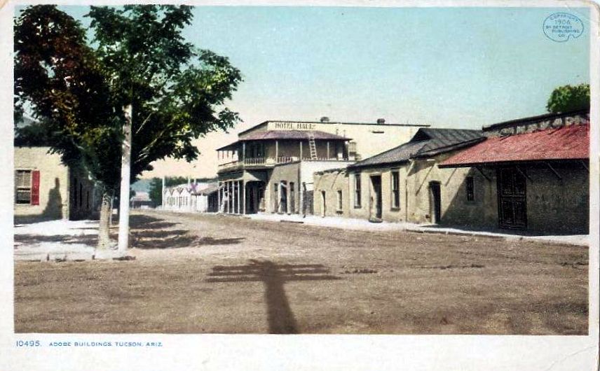
Despite a nation-wide recession, Tucson formed a village government and held its first municipal election in 1873. As the largest town in Arizona it was the supply center for all of southern and eastern Arizona, noted Richard J. Hinton in 1877, with eight or nine merchants pulling in $1.2 million in business on average each year. (Handbook to Arizona, p.271) In 1877, Tucson incorporated as a city. The first two banks opened in 1879. Banking had previously been offered by mercantile establishments. March 10, 1880, Southern Pacific Railroad tracks were built into Tucson from the west coast, continuing to El Paso the following year.
The coming of the railroad changed Tucson dramatically. Shipping costs fell, travelers came in large numbers and Anglos increased their control over government and the economy. They wanted the Old Pueblo to appear a modern city of prosperity and rule of law. “The future building material for Tucson will be brick and stone. The adobe must go, likewise the mud roof. They belong in the past and with the past they must remain.” (Arizona Daily Star, 20 Aug. 1892, quoted in p. 2, Archaeology In Tucson newsletter of Center for Desert Archaeology, Summer, 1996) Land sales boomed, part of the motivation for changing the appearance of the town, but then collapsed. Still, the makeover of the “ancient and honorable pueblo” would continue for another hundred years.
Under Spanish domination, Tucson had developed along the royal road, El Camino Real, running north and south through the Santa Cruz valley. It was really the only regular “street” in town until after 1866. Even when Anglo businessmen first came, their commercial buildings were along this road, renamed Main Street. After the railroad arrived Anglo businessmen developed Congress, and Stone, probably the widest street in town, and set about widening west Congress. It’s surprising to consider how much Tucson changed during a slow economy, even as the population dropped by almost one-third between 1880 and 1890.


By 1902, the appearance of Tucson had been transformed by renaming and realigning streets and adding a European business district and Victorian style neighborhoods surrounding the old Mexican pueblo on the north and east. Connell’s 1901 city directory explained the contrast. “Many of the streets are narrow and tortuous, being walled in by square adobe houses, while others are wide and beautiful, and bordered on both sides by costly dwellings.
“For many years Tucson was a dull, dead Mexican town, but today it is growing and advancing with wonderful strides.”


See:
G. W. Barter, Directory of the City of Tucson. . ., (1881)
Charles T. Connell, City of Tucson General and Business Directory 1901
Bernice Cosulich, Tucson, (1953)
Jane Eppinga, Tucson, (2000)
Rochester Ford, Tucson, Arizona, [1902]
A. M. Gustafson, John Spring’s Arizona, (1966)
Allan B. Jaynes, Tucson, Arizona’s Metropolis, [1906]
Alex Jay Kimmelman, “Strictly White and Always Sober. Tucson’s Pioneer Hotels: A Photo Essay.” Journal of Arizona History, Spring 1994, pp. 63-80
T. R. Sorin, Handbook of Tucson and Surroundings, (1880)
Southwestern Mission Research Center, Tucson. A Short History., (1986)
Ike Speelman, Historic Photos of Tucson, (2007)
University of Arizona, Barrio Historico Tucson, [1972]
Anne I Woosley & Arizona Historical Society, Early Tucson, (2008)
Subscribe to:
Posts (Atom)