
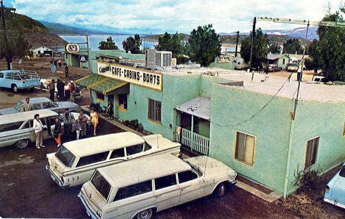
The town of Roosevelt is a service point for recreation on Roosevelt Lake, but it started before there was a lake, to provide goods and services to the workers building Roosevelt Dam. Back then it was located on the riverbank below the planned reservoir level. And as water rose behind the dam, the town had to move to higher ground to survive the flood. In fact, the lake rose behind the dam so rapidly during the spring of 1908 that many of the buildings were submerged before they could be moved, only to reappear during low water levels in the 1930s.
When construction workers first came in 1903, the project was called Tonto Dam or Tonto Basin Dam, after the valley that holds the lake. The dam would be built where the river was squeezed to 200 feet as it entered a rugged canyon just below a point called “The Crossing.” Exactly when the town came to be named Roosevelt is not clear. There is evidence that it was first called Newtown. But the Post Office was established January 22, 1904 as “Roosevelt,” and probably by then everyone knew it would be called Theodore Roosevelt Dam, after the president who supported its construction.


After 20 years of agricultural development beginning in 1867, many fortunes had been made in the Salt River Valley. But just as the ancient indigenous people who eventually abandoned their canals had learned, life in the irrigated oasis was always threatened by flood or drought. The spring freshet of 1886 washed out Arizona Dam at the head of the Arizona canal. Then the great flood of 1891 that put knee-deep water in the streets of Phoenix washed out all the dams on the Salt River. And as soon as the water drained away a period of severe drought set in until the end of the century.
Far-sighted individuals had already concluded there was need of a storage reservoir in the canyons of the Salt River, and the ideal site had been located in 1889, just below the confluence of the Salt with Tonto Creek. Despite agricultural bounty in the Valley, however, funding for such an ambitious project fell short. Private efforts failed twice. Meanwhile, flooding returned in 1900, only to be followed in 1901 by an all-time low level of water in the Salt River. Mass meetings were held in Phoenix’s Dorris Opera House and appeals were made to friends in Washington D.C. After Congress rejected the sale of Maricopa County bonds it provided a solution to the funding problem in the form of the National Reclamation Act, signed by Republican President Teddy Roosevelt June 17, 1902. It came at a time when the federal government was expanding its involvement in the states and the United States had become an imperial power to rival the empires of Europe.
Using the pooled resources of taxpayers across the country, the US Reclamation Service would provide millions of dollars to build the tallest dam in the country and the largest reservoir in the world, to block floods yet keep Salt River Valley canals full. It would be called the “Salt River Project,” the first of many reclamation projects in Arizona and among the first five in the country. Eleven private canal companies in the Valley were united in February 1903 to form the Salt River Valley Water Users Association, a non-profit irrigation company. Farmers and ranchers pledged to pay back the federal government loan, putting up their land as collateral. Hydropower generated by water releases at the dam would subsidize water delivery, with enough excess power to pump ground water beyond the end of canals. None of this came without opposition, but the majority prevailed.

Roosevelt Dam was located in a very remote canyon 40 miles from the railroad at Globe and about 60 miles from Phoenix, inflating the cost of freighting supplies and adding to the difficulty of construction. Contractors reached the site from Globe in 1903, while construction of a road from Mesa, to be called the Apache Trail, continued for another three years. Houses for workers and a few stores were built on a hillside within walking distance of the dam site. The town and O’Rourke’s camp were provided with water and sewer lines, an ice plant, telephones and electricity. Roosevelt had utilities other towns in Arizona wished for. It also went without something every other boomtown had. The government forbade the sale of alcohol. Brick and lime kilns were completed in 1904, the same year a telephone line was strung to Phoenix and the road from Globe was completed. Work had begun on a cement plant. John M. O’Rourke & Co. of Galveston, Texas won the low bid to construct just the dam in March 1905 for a cost reported in the press of $1.1 million.


To provide electricity, first a small wood-fired plant was built. It required 25 cords of wood a day and all scrub trees were soon stripped from the hills for ten miles around. An oil-fueled electric plant started up when oil delivery became available by mule wagons over the road from Mesa. Ultimately the plan was to use hydropower, and work began on a 19-mile power canal with 21 tunnels and two inverted siphons from a diversion dam on the Salt River. But it soon became apparent that the project would cost much more than first estimated. The power canal originally allotted $188,360 for construction gobbled up $1.4 million, plus another $127,000 for the diversion dam.
A 480-foot diversion tunnel, that could be used later to sluice silt from the lake, was bored through the south wall of the canyon in 1904. Cofferdams were built to isolate the worksite and the riverbed was excavated to bedrock over the winter of 1905-1906. In November 1905 came a flood of Biblical proportions. The river rose nearly 30 feet in 15 hours and overtopped the cofferdams. It became apparent that the diversion tunnel was too small and nothing could be done to prevent water from inundating the work every time the Salt River rose to flood stage. After years of drought, construction had unfortunately begun at the start of a period of record stream flows. Finally, the first stone was placed on clean bedrock September 20, 1906. Two months later work halted as the foundation stones disappeared beneath the raging river. Laying stones resumed in June 1907, interrupted by floods in summer and fall. While two years had originally been allotted for construction, four years, seven months and 21 days would pass before stones reached 150 feet on only the south side. It would require six years to complete 280 feet of masonry running 723 feet between spillways.


Immigrants were welcomed as cheap labor in the United States in those days and many different nationalities, including native-born Blacks, worked at Roosevelt. Italians were adept stonecutters. Apache men did much of the work on the road that would later be named after them, proving particularly skillful at laying dry masonry to support the roadbed on the side of cliffs. Still, a strict segregation of labor was maintained, with Anglos in supervisory positions and people of color assigned manual labor.
The temporary hydropower plant provided electricity from April 1906 until August 1909. At that time the permanent hydropower plant constructed (1906-1908) of stone on the south side of the river started up three turbines. In October 1909 electricity was supplied to Valley cities over a 75-mile, 45,000-volt transmission line constructed 1907-1909. Water was supplied to Valley canals at Granite Reef diversion dam (constructed by the Reclamation Service Oct.1906-Aug.1908).
Cost of the dam had ballooned past $3 million, far above the original estimate of $1.9 million. Add to that the expensive power canal, at least a million dollars spent acquiring land and another $2.3 million for the electric power system. “Because of heavy flooding that wreaked havoc with the construction site, it may have been impossible for any company or organization to have built Roosevelt Dam in a timely, cost effective manner,” concluded an official history (Billington, et al., 2005). Flooding showed the need, but residents in the Salt River Valley became impatient for completion and unhappy with Reclamation Service performance and looked for ways to reduce the cost they would have to repay. The last stone on the dam was finally laid February 5, 1911, but O’Rourke’s workers had already begun leaving during the previous year.


Another two generators were added at Roosevelt Dam in 1912, and spillways were raised five feet in 1913. A sixth generator was added in November 1915. After five years only half full, rain in the mountains filled the lake to 225 feet at the dam and water first began to flow through the spillways on the evening of April 15, 1915. Repairs to the spillways were made from October 1915 to January 1916, and completed just four days before the next spillover. Roosevelt Lake reached a maximum storage of 1.5 million acre-feet, and 2.1 million acre feet were measured over the spillways from January 18 through May 30, 1916. The water level almost touched the underside of the automobile bridges on each side and the dam shook for weeks as if by an earthquake under the weight of water eleven and a half feet deep rushing through the spillways.


The final cost of the project came to more than $10 million and the ten-year repayment schedule had to be extended to twenty by an act of Congress in 1914. In 1917, the Reclamation Service turned over operation of Roosevelt Dam to the Water Users Association, retaining mortgage holder interests. But the Association could not make loan payments during the recession years of 1920 and 1921. As soon as the economy improved, the Association sold bonds to build five additional dams on the Salt and Verde Rivers beginning in 1923. That same year, spillway gates were added to Roosevelt Dam, raising the lake another 15 feet, and in 1936 spillway floors were improved to minimize damage during overflow. By 1925 irrigation and power infrastructure represented an investment of more than $23 million. In 1937, the Association created the Salt River Project Agricultural Improvement and Power District, an autonomous government entity, so the state legislature could grant it favorable municipal bonding powers. Drought nearly emptied Roosevelt Lake by June 1940. Then it quickly filled and spilled over in 1941. After World War Two, the Association had trouble paying taxes, so it transferred the electric utility to the tax-exempt District, creating today’s SRP. In 1955, water users paid off the federal loan thirty-five years late.

The need for more water, earthquake protection and a calculated increase in the volume of “hundred-year floods” caused the federal government in 1984 to authorize raising the height of Roosevelt Dam. Work started in 1989 but had to be delayed when the Salt River again produced a torrent. Storms in the watershed brought the lake to its highest level ever on January 19, 1993. The south spillway could not channel all the flow and water overtopped the sidewall and began pouring onto the roof of the hydropower house, causing a million dollars damage. By then a new 1,080-foot long suspension arch highway bridge had opened behind the dam. When work resumed on the dam, the front was covered over with concrete to thicken it and raise it. At a cost of $424 million the top of the dam was raised 77 feet. Now, only at low water levels can the original sandstone blocks be seen on the upstream wall. Since the original structure had disappeared, the dam’s National Historic Landmark status designated in 1963 was withdrawn in 1999.
See:
Donald N. Bentz, “The Doomed City” Frontier Times May 1968.
David P. Billington, et al., The History of Large Federal Dams. . . (US Bureau of Reclamation, 2005)
Kathleen Garcia, Roosevelt Dam (2009)
Athia L. Hardt, ed., Arizona Waterline [1989]
L. L. Lombardi, Tortilla Flat Then & Now (1996)
Salt River Project, The Taming of the Salt (1970)
Stephen C. Shadegg, Century One (1969)
Chester W. Smith, “The Building of the Roosevelt Dam” The Earth August 1909
Karen L. Smith, The Magnificent Experiment, Building the Salt River Reclamation Project, 1890-1917 (1986)
US Dept. of Interior, USGS, US Reclamation Service, annual reports: 1903-04, 1915-16.
Earl A. Zarbin, Roosevelt Dam: A History to 1911 (1984)